The Harmed Success Stories Concepts How To What Is Commentary
Fayette County Marcellus Shale Permits 2/9/15 - 2/22/15
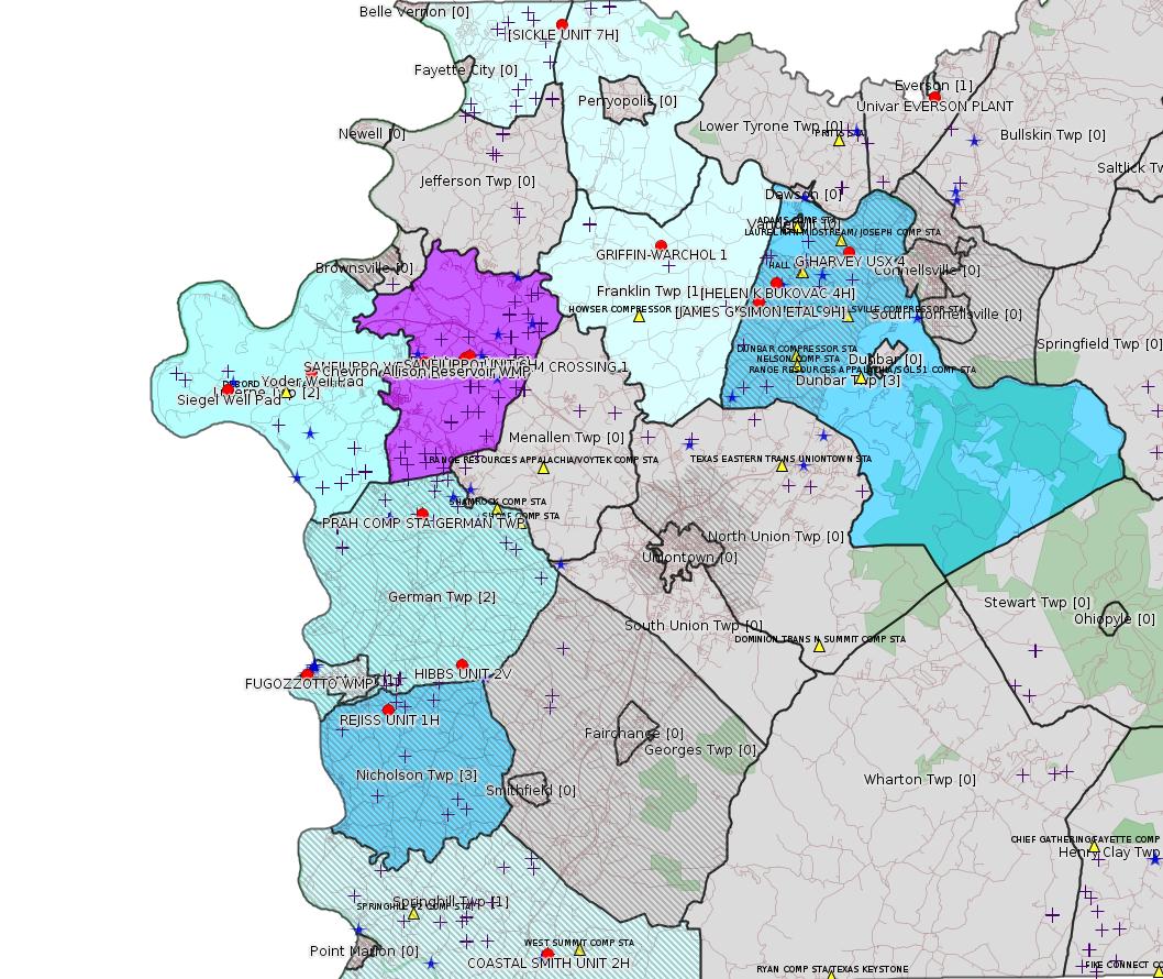
Click the map to enlarge
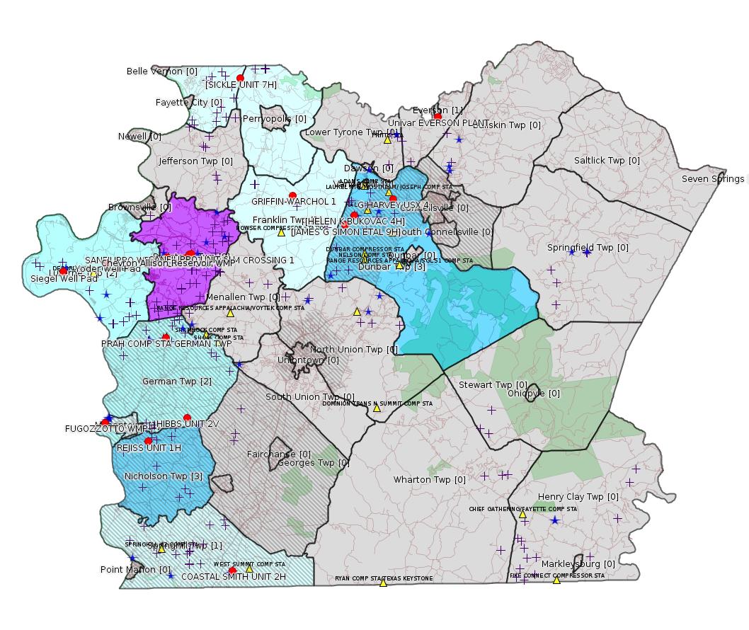
Map
Key
Red dots: items in this permit list with an exact location.
Orange triangles: Notifications in this permit list with an exact location.
Blue stars: Marcellus Gas Well Water Sources.
Municipality shading: number of "facilities", with each well counting separately
(includes the red dots):
Red dots: items in this permit list with an exact location.
Orange triangles: Notifications in this permit list with an exact location.
Blue stars: Marcellus Gas Well Water Sources.
Municipality shading: number of "facilities", with each well counting separately
(includes the red dots):
gray: 0
pale turquoise: 1
turquoise: 2
pale blue: 3
middle blue: 4
dark blue: 5
dark purple: 7
purple: 8
(Color coding may differ from one issue to the next.)
(Note if a project spans multiple municipalities -- e.g. a pipeline -- it will show in the count for each municipality.)
The number of facilities also follows the municipality name in brackets.
Municipality counts are based on the way the permit is listed by DEP; DEP has been known to get a municipality wrong.
Locations in brackets identify a precise location used to locate the actual site being permitted (e.g. locating a well pad or pipeline by the known location of a well.) Locations labeled beginning with "~" and ending in "[?]" are approximate and speculative based on inferences using on-line property and lease records. These are marked in the text as "[Approximate, Speculative]
eFACTS/eNOTICE applications of type Notification are not mapped.
Cross-hatching: Environmental Justice Areas
Yellow triangles: Compressor Stations
Crosses: Unconventional well permits (may not have been drilled)
Green: "Natural areas", e.g. state game lands, state forests
Yellow triangles: Compressor Stations
Crosses: Unconventional well permits (may not have been drilled)
Green: "Natural areas", e.g. state game lands, state forests
More Maps
 |
 |
Source: Pennsylvania Bulletin
THE GOVERNOR
Title 4—ADMINISTRATION
[45 Pa.B. 766]
[Saturday, February 14, 2015]
PART I. GOVERNOR'S OFFICE
[ 4 PA. CODE CH. 1 ]
[ EXECUTIVE ORDER NO. 2015-03 ]
Leasing of State Forest and State Park Land for Oil and Gas Development
January 29, 2015
Whereas, Section 27 of Article I of the Constitution of Pennsylvania guarantees the Commonwealth's citizens the right to clean air, pure water and to the preservation of the natural, scenic, historic and aesthetic values of the environment; and
Whereas, the Department of Conservation and Natural Resources (DCNR) has a duty pursuant to the Conservation and Natural Resources Act (Act of June 28, 1995, P. L. 89, No. 18) (CNRA) to conserve and maintain State Forests and State Parks in the public trust for the use and benefit of all its citizens, and generations yet to come, as guaranteed by Section 27 of Article I of the Constitution of Pennsylvania; and
Whereas, Pennsylvania's award-winning State Parks provide opportunities for enjoying healthful outdoor recreation and serve as outdoor classrooms for environmental education, and in meeting these purposes host 38 million visitors annually, support over 13,000 jobs, and provide $1.2 billion to the state's economy; and
Whereas, leasing State Park land for oil and gas development is contrary to DCNR's longstanding policy; and
Whereas, Pennsylvania's 2.2 million-acre State Forest system has been certified longer than any other State Forest system in the United States through an independent scientific review to be compliant with the gold standard for environmentally and socially responsible forestry established by the international Forest Stewardship Council (FSC), and this certification is vital to the economic viability of the forest products industry in Pennsylvania; and
Whereas, more than 673,000 acres of the State Forest land are currently open to oil and gas development through DCNR-issued leases (386,000 acres) or because of privately-owned mineral rights where the Commonwealth does not own the subsurface oil and gas (287,000 acres); and
Whereas, according to an analysis completed in 2010 by DCNR, the portion of State Forest land that is currently not available for oil and gas development is vital for maintaining pure water, wild and natural ecosystems and valuable recreational opportunities that support Pennsylvania's eco-tourism industry; and
Whereas, based on data gathered through 2012, while still piloting and developing monitoring and management tools and protocols, DCNR has found that that ''there are clearly impacts and tradeoffs that are associated with'' oil and gas development on State Forest land, as well as risks to the resources, the uses of the forest, and the balance among them; and
Whereas, the complex, interrelated, and significant impacts already identified by DCNR and others include clearing of almost 1,500 acres, degraded wild character and recreational experiences on over 9,300 acres, heavy truck traffic, forest conversion and fragmentation and soil disturbance, invasive species, hiking and snowmobile trail conflicts, loss of scenic vistas, noise pollution affecting recreational experiences and wildlife, and reduction in timber harvest revenues due to road bonding costs; and
Whereas, DCNR has concluded that in order to develop a full understanding of the cumulative impacts of oil and gas development on State Forest and State Park land, additional longitudinal research and monitoring on a wide variety of impacts and risks are needed, including air quality, water quality, groundwater, soil, the effects of evolving DCNR-prescribed best management practices, the effects of pipeline stream crossings, wildlife, noise pollution, and timber harvesting; and
Whereas, DCNR has concluded that additional leasing of State Forest land or State Park land for oil and gas development would jeopardize DCNR's ability to fulfill its legislative duty to conserve and maintain these public natural resources, and to sustain its FSC forest certification;
Now, Therefore, I, Tom Wolf, Governor of the Commonwealth of Pennsylvania, by virtue of the authority vested in me by the Constitution of the Commonwealth of Pennsylvania and other laws (including the CNRA), and consistent with recommendations made by the Acting Secretary of Conservation and Natural Resources, do hereby direct the following.
Governor
Fiscal Note: GOV-15-03. No fiscal impact; (8) recommends adoption.
Annex A
TITLE 4. ADMINISTRATION
PART I. GOVERNOR'S OFFICE
CHAPTER 1. AGENCY OPERATION AND ORGANIZATION
Subchapter ZZ. (Reserved)
§§ 1.701—1.705. (Reserved).
Subchapter BBB. LEASING OF STATE FOREST AND STATE PARK LAND FOR OIL AND GAS DEVELOPMENT
Sec.
1.811. Department of Conservation and Natural Resources oil and gas leasing.
1.812. Effective date.
1.813. Termination date.
1.814. Rescission.
§ 1.811. Department of Conservation and Natural Resources oil and gas leasing.
As of January 29, 2015, to protect the lands of this Commonwealth that are held in trust for its citizens and for future generations, and subject to future advice and recommendations made by the Department of Conservation and Natural Resources (Department), no State Park and State Forest lands owned or managed, or both, by the Department shall be leased for oil and gas development.
§ 1.812. Effective date.
This subchapter is effective immediately.
§ 1.813. Termination date.
This subchapter shall remain in effect until amended or rescinded by the Governor.
§ 1.814. Rescission.
Effective immediately, Executive Order 2014-03 is rescinded.
<http://www.pabulletin.com/secure/data/vol45/45-7/259.html>
---
Helen Bukovac #4 Well Site, 760 Little Summit Road Extension, Dunbar Township, Fayette County. Groundwater & Environmental Services, Inc., 301 Commerce Park Drive, Cranberry Township, PA 16066 on behalf of XTO Energy Inc., 395 Airport Road, Indiana, PA 15701 submitted a Final Report concerning the remediation of site soils contaminated with aluminum, antimony, arsenic, barium, beryllium boron, cadmium chromium, cobalt, copper, iron lead, manganese, mercury, nickel, selenium, silver, thallium, vanadium, zinc and chloride. The Final Report demonstrated attainment of a Site Specific standard for chlorides and a residential Statewide Health standard for all other constituents sampled for in soils, and was approved by the Department on January 27, 2015.
<http://www.pabulletin.com/secure/data/vol45/45-7/270c.html>
Site: HELEN BUKOVAC #4 WELL SITE
Site ID: 783992
Location [of HELEN K BUKOVAC 4H] 40.010133,-79.672622 [an Environmental Justice Area]
<http://osm.org/go/ZWp2lQXc--?m=>
---
ESCGP-2 NO.: ESX14-051-0005
Applicant Name: XTO Energy Inc
CONTACT: Melissa Breitenbach
ADDRESS: 502 Keystone Drive
City: Warrendale State: PA Zip Code: 15086
County: Fayette Township(s): Dunbar
Receiving Stream(s) and Classifications: Bute Run
(WWF)/Monongahela River Watershed; Other WWF
<http://www.pabulletin.com/secure/data/vol45/45-7/270d.html>
Site: JAMES G SIMON 9H, 10H, 11H OG WELL ESCGP-2 EXPEDITED
Location [of JAMES G SIMON ETAL 9H]: 40.002533,-79.682167 [an Environmental Justice Area]
<http://osm.org/go/ZWp2OlhH--?m=>
-------------------------
Source: eNOTICE (+ PA Oil and Gas Mapping)
[Conventional Well:]
Authorization ID: 1060028
Permit number: 051-24139
Site: GRIFFIN-WARCHOL 1 OG WELL
Client: XTO ENERGY INC
Authorization type: Well Plugging Notice Intent to Plug Single Well
Application type: New
Authorization is for: FACILITY
Date received: 01/20/2015
Status: Issued on 2/17/2015
Sub-Facility ID Sub-Facility Name Description
981789 GRIFFIN-WARCHOL 1 Well
<http://www.ahs.dep.pa.gov/eFACTSWeb/searchResults_singleAuth.aspx?AuthID=1060028>
Location: 40.026036,-79.734489 <http://osm.org/go/ZWp08aDr--?m=>
Municipalities: Franklin Twp
Authorization ID: 1060092
Permit number: 051-24515
Site: REJISS UNIT 1H OG WELL
Client: CHEVRON APPALACHIA LLC
Authorization type: Alternate Waste Management Practice
Application type: New
Authorization is for: FACILITY
Date received: 11/26/2014
Status: Issued on 2/10/2015
Sub-Facility ID Sub-Facility Name Description
1082533 REJISS UNIT 1H Well
1082534 REJISS UNIT 2H Well
1134034 REJISS UNIT 2H Well
1082551 REJISS UNIT 2H Well
1134033 REJISS UNIT 2H Well
1082535 REJISS UNIT 3H Well
<http://www.ahs.dep.pa.gov/eFACTSWeb/searchResults_singleAuth.aspx?AuthID=1060092>
Location [of REJISS UNIT 1H]: 39.835447,-79.884836 <http://osm.org/go/ZWpOF2yQ--?m=>
Municipalities: Nicholson Twp
Authorization ID: 1060948
Permit number: ESX15-051-0004
Site: SICKLE PIPELINE ESCGP-2 EXPEDITED
Client: CHEVRON APPALACHIA LLC
Authorization type: Expedited E&S Stormwater General Permit 1
Application type: New
Authorization is for: SITE
Date received: 02/04/2015
Status: Pending
<http://www.ahs.dep.pa.gov/eFACTSWeb/searchResults_singleAuth.aspx?AuthID=1060948>
Location [of SICKLE UNIT 7H]: 40.1185,-79.786619 <http://osm.org/go/ZWsgXmWN--?m=>
Municipalities: Perry Twp, Washington Twp
Authorization ID: 1056783
Permit number: 051-24571
Site: SANFILIPPO WELL SITES ESCGP-EXPEDITED
Client: CHEVRON APPALACHIA LLC
Authorization type: Drill & Operate Well Permit Drill Deeper
Application type: New
Authorization is for: FACILITY
Date received: 12/09/2014
Status: Issued on 2/11/2015
Sub-Facility ID Sub-Facility Name Description
1151560 SANFILIPPO UNIT 1H Well
<http://www.ahs.dep.pa.gov/eFACTSWeb/searchResults_singleAuth.aspx?AuthID=1056783>
Location: 39.978397,-79.844650 <http://osm.org/go/ZWpbxc_6--?m=>
Municipalities: Redstone Twp
Conservation Well: N
Full Permit:
<http://www.depgis.state.pa.us/PaOilAndGasMapping/PdFFetcher.ashx?Doc=PKKSrz1rIcjp5yh1i1UKyQ%3d%3d&ext=PDF>
Authorization ID: 1056784
Permit number: 051-24572
Site: SANFILIPPO WELL SITES ESCGP-EXPEDITED
Client: CHEVRON APPALACHIA LLC
Authorization type: Drill & Operate Well Permit Drill Deeper
Application type: New
Authorization is for: FACILITY
Date received: 12/09/2014
Status: Issued on 2/11/2015
Sub-Facility ID Sub-Facility Name Description
1151561 SANFILIPPO UNIT 2H Well
<http://www.ahs.dep.pa.gov/eFACTSWeb/searchResults_singleAuth.aspx?AuthID=1056784>
Conservation Well: N
Full Permit:
<http://www.depgis.state.pa.us/PaOilAndGasMapping/PdFFetcher.ashx?Doc=DwyL2G5yrD%2fXp9G%2fWeJjpA%3d%3d&ext=PDF>
Authorization ID: 1059335
Permit number: GP05260715001
Site: SANFILIPPO WELL CONNECT GP5 & GP8
Client: CHEVRON APPALACHIA LLC
Authorization type: GP-05 Utility Line Stream Crossings
Application type: New
Authorization is for: FACILITY
Date received: 01/28/2015
Status: Pending
Sub-Facility ID Sub-Facility Name Description
1153609 STREAM CROSSING 1 Pipeline or Conduit
<http://www.ahs.dep.pa.gov/eFACTSWeb/searchResults_singleAuth.aspx?AuthID=1059335>
Location: 39.981039,-79.840847 <http://osm.org/go/ZWpb0myc--?m=>
Municipalities: Redstone Twp
Authorization ID: 1059336
Permit number: GP08260715001
Site: SANFILIPPO WELL CONNECT GP5 & GP8
Client: CHEVRON APPALACHIA LLC
Authorization type: GP-08 Temporary Road Crossings
Application type: New
Authorization is for: FACILITY
Date received: 01/28/2015
Status: Pending
Sub-Facility ID Sub-Facility Name Description eMap PA Location
1153611 STREAM CROSSING 2 Floodway Activity
<http://www.ahs.dep.pa.gov/eFACTSWeb/searchResults_singleAuth.aspx?AuthID=1059336>
Authorization ID: 1056739
Permit number: 051-24575
Site: SANFILIPPO WELL SITES ESCGP-EXPEDITED
Client: CHEVRON APPALACHIA LLC
Authorization type: Drill & Operate Well Permit Drill Deeper
Application type: New
Authorization is for: FACILITY
Date received: 12/09/2014
Status: Issued on 2/12/2015
Sub-Facility ID Sub-Facility Name Description eMap PA Location
1151565 SANFILIPPO UNIT 6H Well
<http://www.ahs.dep.pa.gov/eFACTSWeb/searchResults_singleAuth.aspx?AuthID=1056739>
Location: 39.981577,-79.838819 <http://osm.org/go/ZWpb0vHD--?m=>
Municipalities: Redstone Twp
Conservation Well: N
Full Permit:
<http://www.depgis.state.pa.us/PaOilAndGasMapping/PdFFetcher.ashx?Doc=KPZR%2f%2fHKdDS26ZCnQeoL4g%3d%3d&ext=PDF>
Authorization ID: 1056785
Permit number: 051-24573
Site: SANFILIPPO WELL SITES ESCGP-EXPEDITED
Client: CHEVRON APPALACHIA LLC
Authorization type: Drill & Operate Well Permit Drill Deeper
Application type: New
Authorization is for: FACILITY
Date received: 12/09/2014
Status: Issued on 2/12/2015
Sub-Facility ID Sub-Facility Name Description
1151562 SANFILIPPO UNIT 3H Well
<http://www.ahs.dep.pa.gov/eFACTSWeb/searchResults_singleAuth.aspx?AuthID=1056785>
Conservation Well: N
Full Permit:
<http://www.depgis.state.pa.us/PaOilAndGasMapping/PdFFetcher.ashx?Doc=uAFMu6gDYCTrj%2fwcwwMqkQ%3d%3d&ext=PDF>
Authorization ID: 1056816
Permit number: 051-24574
Site: SANFILIPPO WELL SITES ESCGP-EXPEDITED
Client: CHEVRON APPALACHIA LLC
Authorization type: Drill & Operate Well Permit Drill Deeper
Application type: New
Authorization is for: FACILITY
Date received: 12/09/2014
Status: Issued on 2/12/2015
Sub-Facility ID Sub-Facility Name Description
1151563 SANFILIPPO UNIT 4H Well
<http://www.ahs.dep.pa.gov/eFACTSWeb/searchResults_singleAuth.aspx?AuthID=1056816>
Conservation Well: N
Full Permit:
<http://www.depgis.state.pa.us/PaOilAndGasMapping/PdFFetcher.ashx?Doc=1YuytF3EDZpZaMnkIzzuSQ%3d%3d&ext=PDF>
Authorization ID: 1056818
Permit number: 051-24556
Site: SANFILIPPO WELL SITES ESCGP-EXPEDITED
Client: CHEVRON APPALACHIA LLC
Authorization type: Drill & Operate Well Permit Drill Deeper
Application type: New
Authorization is for: FACILITY
Date received: 12/09/2014
Status: Issued on 2/12/2015
Sub-Facility ID Sub-Facility Name Description
1151564 SANFILIPPO UNIT 5H Well
<http://www.ahs.dep.pa.gov/eFACTSWeb/searchResults_singleAuth.aspx?AuthID=1056818>
Conservation Well: Y [Incorrect, See Notes -jr]
Full Permit:
<http://www.depgis.state.pa.us/PaOilAndGasMapping/PdFFetcher.ashx?Doc=NOHgfspZXuYt1qoRNti1jw%3d%3d&ext=PDF>
Authorization ID: 1051811
Permit number: GP5-26-00546B
Site: PRAH COMP STA GERMAN TWP
Client: LAUREL MTN MIDSTREAM OPR LLC
Authorization type: AQ General Permit
Application type: New
Authorization is for: FACILITY
Date received: 11/21/2014
Status: Issued on 2/12/2015
Sub-Facility ID Sub-Facility Name Description eMap PA Location
943514 CATERPILLAR G3516TALE 1340 BHP ENGINE 1 Process
943546 CATERPILLAR G3516TALE 1340 BHP ENGINE 2 Process
943551 DEHYDRATOR 0.50 MMBTU/HR Process
943565 FLARE 6.75 MMBTU/HR FOR 0.50 DEHYDRATOR Air Pollution Control Device
1126758 OX CATALYST FOR CAT ENGINE 1 Air Pollution Control Device
1126759 OX CATALYST FOR CAT ENGINE 2 Air Pollution Control Device
<http://www.ahs.dep.pa.gov/eFACTSWeb/searchResults_singleAuth.aspx?AuthID=1051811>
Location: 39.916422,-79.865258 <http://osm.org/go/ZWpaMa6C--?m=>
Municipalities: German Twp [an Environmental Justice Area]
Fayette County Parcel ID 15-11-0031
Authorization ID: 1054727
Permit number: 051-24618
Site: COASTAL 1H FLOW BACK PIT FRESHWATER PITS ESCGP-EXPEDITED
Client: BURNETT OIL CO INC
Authorization type: Drill & Operate Well Permit
Application type: New
Authorization is for: FACILITY
Date received: 12/17/2014
Status: Pending
Sub-Facility ID Sub-Facility Name Description
1150653 WELLBORE SURFACE HOLE LOCATION Well
<http://www.ahs.dep.pa.gov/eFACTSWeb/searchResults_singleAuth.aspx?AuthID=1054727>
Location: 39.733371,-79.80094 <http://osm.org/go/ZWpgBJ3s--?m=>
Municipalities: Springhill Twp [an Environmental Justice Area]
(Well) Farm Name / Well #: COASTAL SMITH UNIT 2H
Conservation Well: N
Permit Application:
<http://www.depgis.state.pa.us/PaOilAndGasMapping/eWellDocServiceFetcher.ashx?Doc=5xEy7%2f39Ax%2f4CX%2ff%2fOCsug%3d%3d>
Authorization ID: 1061896
Permit number: 26-00595
Site: EVERSON PLANT
Client: MAGNABLEND INC
Authorization type: Minor Source Operating Permit
Application type: New
Authorization is for: FACILITY
Date received: 02/18/2015
Status: Pending
<http://www.ahs.dep.pa.gov/eFACTSWeb/searchResults_singleAuth.aspx?AuthID=1061896>
Location: 40.085978,-79.58585 <http://osm.org/go/ZWsoLvNt--?m=>
Municipalities: Bullskin Twp [??? -jr], Everson Boro
[See Notes.]
Authorization ID: 1062037
Permit number: 051-24604
Site: HIBBS 1H ESCGP-EXPEDITED
Client: BURNETT OIL CO INC
Authorization type: Drill & Operate Well Permit
Application type: Renewal
Authorization is for: FACILITY
Date received: 01/16/2015
Status: Withdrawn on 2/19/2015
<http://www.ahs.dep.pa.gov/eFACTSWeb/searchResults_singleAuth.aspx?AuthID=1062037>
Location [Prior permit shows Farm Name HIBBS UNIT 2V]: 39.853602,-79.844852 <http://osm.org/go/ZWpO1JoA--?m=>
Municipalities: German Twp [an Environmental Justice Area], Nicholson Twp [??? -jr]
-------------------------
Source: Fayette County Zoning Hearing Board
NOTICE
ZHB HEARINGS
Notice is hereby given that the Fayette County Zoning Hearing Board will
hold a public hearing in the Fayette County Public Service Building, 22
East Main Street, Uniontown, Pennsylvania, to hear the following
petitions:February 25, 2015
11:30 a.m. EST / Case ZHB 15-11, Masontown Boro.
To hear the petition of Michael Fugozzotto & Shane Closkey, 205 Carmichaels
Plaza, Carmichaels, PA. Said petition requests the Board to grant a Special
Exception for a Public / Private Works Facility, a water withdrawal
facility on property zoned "M-1" and is shown on Tax Map 21-04-0004.
Interested persons may appear at the aforementioned hearings to offer
testimony in favor of or in opposition to the requested petitions. Only
Attorneys are permitted to represent individuals before the Board. A
request for a continuance of a hearing must be made to the Office of
Planning, Zoning and Community Development, Pertinent records may be
inspected prior to the hearing at the Office of Planning, Zoning and
Community Development.FAYETTE COUNTY ZONING HEARINTG BOARD
<http://pa.mypublicnotices.com/PublicNotice.asp?Page=PublicNotice&AdId=3740464>
Location: 39.850443,-79.928000 <http://osm.org/go/ZWpM04Hm--?m=>
WMP GIS Record Metadata:
SF_NAME: MONONGAHELA RIVER @ FUGOZZOTTO
PF_NAME: ENERGY CORP OF AMERICA
FAC_TYPE_D: Surface Water Withdrawal
FAC_DESC: Instream Dvrsn-River,Stream,Creek Intake
PEAK_DAILY: 0.0
MAX_RATE: 0.0
AVG_DAILY: 0.0
PASSBY_REQ: N
PASSBY_AMT: 0.0
APPR_DATE: Fri Jun 20 00:00:00 EDT 2014
EXP_DATE: Thu Jun 20 00:00:00 EDT 2019
REG_OFFICE: SWRO
CNTY_NAME: Fayette
MUNI_NAME: Masontown
WMP_ID: 422385.0
ORG_WMP_ID: 42238-WMP7-007
WUDS_PWSID: 0.0
WUDS_SFID: 66155.0
WUDS_PFID: 59601.0
-------------------------
Source: Fayette County Planning Commission February 2014 Agenda
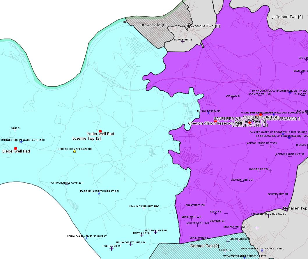
Chevron Appalachia, LLC sending notification of intent to apply to DEP for coverage under the Erosion & Sediment Control General Permit (ESCGP-2) for earth disturbance associated with oil & gas exploration, production, processing or treatment operations or transmission facilities for the Yoder Well Pad project located in Luzerne Township.
Location: 39.97565,-79.924014 <http://osm.org/go/ZWpZzGUo--?m=>
6 wells?
Chevron Appalachia, LLC sending notification of intent to apply to DEP for coverage under the Erosion & Sediment Control General Permit (ESCGP-2) for earth disturbance associated with oil & gas exploration, production, processing or treatment operations or transmission facilities for the Siegel Well Pad project located in Luzerne Township.
Location: 39.969097,-79.968992 <http://osm.org/go/ZWpZSBPr--?m=>
10 wells?
Tetra Tech, Inc. sending notification of intent to apply to DEP for a Water Management Plan for the withdrawal of water associated with oil & gas exploration located in Redstone Township.
Location: 39.979422,-79.8627634 <http://osm.org/go/ZWpbcimi--?m=>
-------------------------
Source: Oil and Gas Compliance Report
[Conventional Well:]
OPERATOR: KEYROCK ENERGY LLC
INSPECTION_ID: 2343073
INSPECTION_DATE: 02/10/2015
INSPECTION_TYPE: Administrative/File Review
API_PERMIT: 051-21013
FARM_NAME: G HARVEY USX 4
UNCONVENTIONAL: N
SITE_ID: 489985
SITE_NAME: G HARVEY USX 4 OG WELL
FACILITY_TYPE: Oil & Gas Location
INSPECTION_CATEGORY: Primary Facility
REGION: EP DOGO SWDO Dstr Off
COUNTY: Fayette
MUNICIPALITY: Dunbar Twp
INSPECTION_RESULT_DESCRIPTION: Outstanding Violations - No Viols Req'd
INSPECTION_COMMENT: "02/05/15
Today I contacted Mr. Mike BUCHEIT of Keyrock Energy LLC at 724-771-4275. BUCHEIT indicated that Keyrock does still own the G. Harvey USX#4 site and that a lawsuit is active between Keyrock and HARVEY regarding the spill from 2012. BUCHEIT indicated that Keyrock has not remediated the site due to the land owner not permitting them access. The investigation is ongoing pending contact with the property owner Mr. George HARVEY.
02/10/15
Today at approximately 1320 hours I contacted Mr. George HARVEY regarding the spill on his property. HARVEY informed me that he is still in litigation regarding the spill and has not allowed anyone access to the site. HARVEY also claims that a brown water line had burst near the well site and leaked for approximately 10 months. HARVEY also claimed that he had called in a water supply complaint regarding this issue, but he was not sure if any water testing was completed. The investigation is ongoing looking into the possibility of additional pollution to the site and for the original spill.
"
Location: 40.022269,-79.633041 <http://osm.org/go/ZWp2707r--?m=>
-------------------------
Source: Reuters Commodities: Energy
Natural Gas
| Commodity | Exchange | Currency | Expire | Last Trade | Trade Time | Change | Open | High | Low |
|---|---|---|---|---|---|---|---|---|---|
| NATURAL
GAS CON1 Feb15 |
NYM | USD | 02/25 | 2.88 | 02/22 20:32 | +0.01 | 2.87 | 2.90 | 2.86 |
-------------------------
Notes:
There are two well pads at Sanfilippo and 8 wells; 1H, 2H, and 8H are on the southwest pad and 3H, 4H, 5H, 6H, and 7H are on the northeast pad. Of these 8 wells, only 5H shows in the "data view" on DEP PA Oil & Gas Mapping as a Conservation Well. However, the designation "Conservation Well: Y" for 5H appears to be a data entry error at DEP. Examining the permit, the No box is checked for applicability of the Oil & Gas Conservation Law, and the Well Location Plat shows "No Onondaga Tag" (and the so-called "Onondaga Rat Tail" -- where they drill the vertical part of the well down through the Onondaga and then cement back up to the kickoff point -- does not show either).
---
The Magnablend Everson Plant is evidently a mixing plant for fracking chemicals. They have a prior violation for discharging without a permit:
<http://www.ahs.dep.pa.gov/eFACTSWeb/searchResults_singleViol.aspx?InspectionID=2226981>
Violation ID Date Violation Description
684641 03/13/2013 Industrial waste was discharged without a permit
Resolution: Corrected/Abated
PA Code Legal Citation: P.L. 1987 301 : PA Code Website
Violation Type: Environmental Health & Safety
Related Enforcements
Please note: the following related enforcement data is accumulated from possibly many different sites/facilities that may be unrelated to the facility for this inspection.
Enforcement ID: 305386
Enforcement Type: Notice of Violation
Date Executed: 04/02/2013
Taken Against: MAGNABLEND INC
On Appeal? N
Enforcement Status: Comply/Closed
# of Violations Addressed by this Enforcement and Penalty Action (possibly from many facilities): 1
Although the new permit is for a Minor Source, it does not appear to be a General Permit, which means there should be public comment. When this occurs, it will be important to get as many people to respond as possible to request a hearing. There is an obvious concern about what would happen at this facility in the case of an accident. The plant is currently owned by Univar, which acquired Magnablend. According to the Tribune Review:
"The plan calls for expansion of the rail and trucking facilities to handle railroad tank cars of hydrochloric acid that will be shipped in from West Virginia. The acid, used in the fracking drilling process, will then be transferred to trucks for shipment to drilling sites in the area.
Hydrochloric acid, while corrosive, is not flammable or explosive. The acid is regulated by the federal Environmental Protection Agency."
<http://triblive.com/news/fayette/6041292-74/everson-univar-acid>
------------------------
DEP defines an environmental justice area as "any census tract where 20 percent or more individuals live in poverty, and/or 30 percent or more of the population is minority". (See:
<http://www.portal.state.pa.us/portal/server.pt/community/pa_environmental_justice_areas/20991>
<http://www.portal.state.pa.us/portal/server.pt/community/dep_enhanced_public_participation_policy/20988>
). There are supposed to be enhanced public participation requirements for permits in environmental justice areas, but news of this actually ever happening is scarce. In Fayette County, the entirety of Springhill, Nicholson, German, and Georges Townships are environmental justice areas, as well as a large part of Dunbar Township. DEP's policy document on public participation guidelines for environmental justice areas is located here:
<http://www.elibrary.dep.state.pa.us/dsweb/Get/Version-48671/012-0501-002.pdf>
eNOTICE records are likely to list the same permit multiple times, as that permit moves through the DEP process.
Oil & Gas Wells designated with a site a number and the letter H typically designate horizontal wells.
The eMapPa web site does not work in web browsers other than Internet Explorer. For instructions on how to view eMapPa data in Firefox send me E-mail.
-------------------------
Resources:
Pennsylvania Bulletin: <http://www.pabulletin.com/>
eNOTICE: <http://www.ahs2.dep.state.pa.
DEP Well Details Report: <https://www.paoilandgasreport
Well Details may not show any
information for new permits and will not show permits which have
not yet been issued. Lookup for Well Details is by permit number.
DEP Permits Issued Detail Report:
<http://www.depreportingservic
DEP SPUD (drilling started) Report:
<http://www.depreportingservices.state.pa.us/ReportServer/Pages/ReportViewer.aspx?/Oil_Gas/Spud_External_Data>
DEP Oil and Gas Compliance Report:
<http://www.depreportingservices.state.pa.us/ReportServer/Pages/ReportViewer.aspx?/Oil_Gas/OG_Compliance>
DEP PA Oil & Gas Mapping:
<http://www.depgis.state.pa.us/PaOilAndGasMapping>
Pennsylvania Spatial Data Access:
<http://www.pasda.psu.edu/default.asp>
DEP Spatial Data Repository:
<ftp://www.pasda.psu.edu/pub/pasda/dep/>
National Response Center:
<http://www.nrc.uscg.mil/>
EPA-Echo: <http://www.epa-echo.gov/echo/
FERC citizen involvement: <http://www.ferc.gov/for-citiz
To receive E-mail notification of
all documents filed in a FERC docket, see:
<http://www.ferc.gov/docs-filing/esubscription.asp >
<http://www.ferc.gov/docs-fili
Follow the directions and enter the docket number to subscribe to.
Township Supervisors receive information regarding Erosion & Sedimentation permits, and these records may be reviewable at township municipal offices.
DEP permits are reviewable through the File Review process, for application to do file review see: <http://www.portal.state.pa.us/portal/server.pt/community/southwest_regional_office/13775/file_review/593164>
Environmental Hearing Board: <http://ehb.courtapps.com/publ
PA DEP Public Participation Center Proposals Currently Open for Comment:
<http://www.portal.state.pa.us
This location contains links for
open public comment periods.
Federal Register Environment: <https://www.federalregister.g
Browsing of recent comment
opportunities for federal agencies, e.g. EPA. Click "sign up" to
subscribe to daily E-mails of new document listings.
SkyTruth Fayette County Drilling Alerts: <http://frack.skytruth.org/pen
EPA Region 3 Water Protection Public Notices: <http://www.epa.gov/reg3wapd/p
Marcellus Shale waste disposal
injection wells in Pennsylvania are regulated directly by EPA, not
DEP. Notice of any new permit applications will appear at the
above web address. I'm not aware of any subscription service
to be notified of such applications. I'm not aware of any
Marcellus Shale waste disposal injection wells in Fayette County
(yet ...) but we need to monitor this page for future
applications.
Energy Assurance Daily: <http://www.oe.netl.doe.gov/ead.aspx>
Daily newsletter from the US
Department of Energy about events relating to energy. The Natural
Gas section has information about pipelines.
-------------------------
Disclaimers:
This compilation from the above sources was done by hand using copy and paste and may omit relevant permits.
Does not currently include water supply permits. Does not include landfill permits even though many such are for Marcellus Shale waste. (It is not possible at this time to distinguish which landfill permits are for Marcellus Shale waste and which are not without doing File Review for each permit.)
Erosion & Sedimentation permit records do not currently include latitude and longitude. Where I am publishing latitude and longitude with E&S permits it is by inferring an associated well permit and using published latitude and longitude for the well. It is possible I may be inferring the wrong well site.
Municipalities are shown from eFACTS records on the DEP web site. The DEP has been known to list a municipality incorrectly.