The Harmed Success Stories Concepts How To What Is Commentary
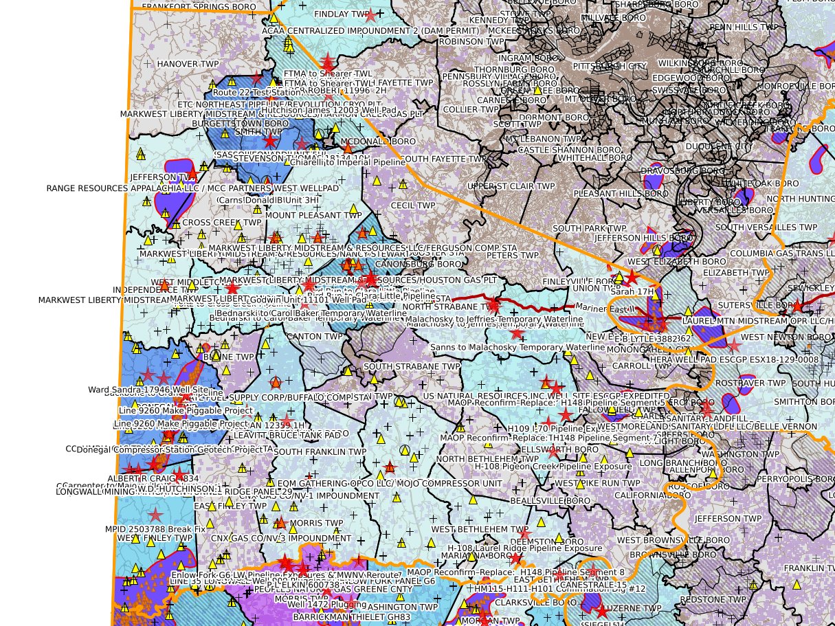
Washington County Oil & Gas Pending and Recently Disposed Permits
Data as of 2026-07-14
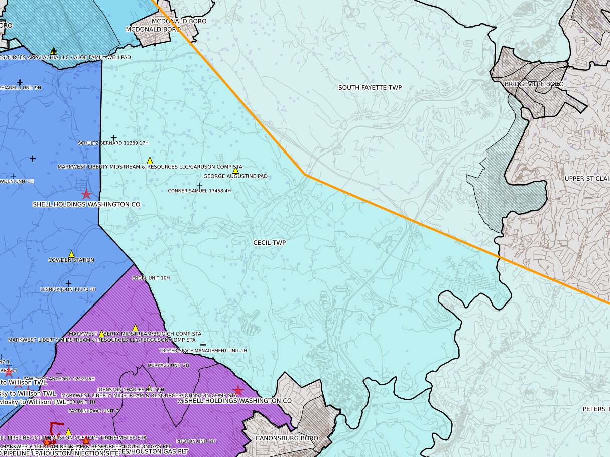
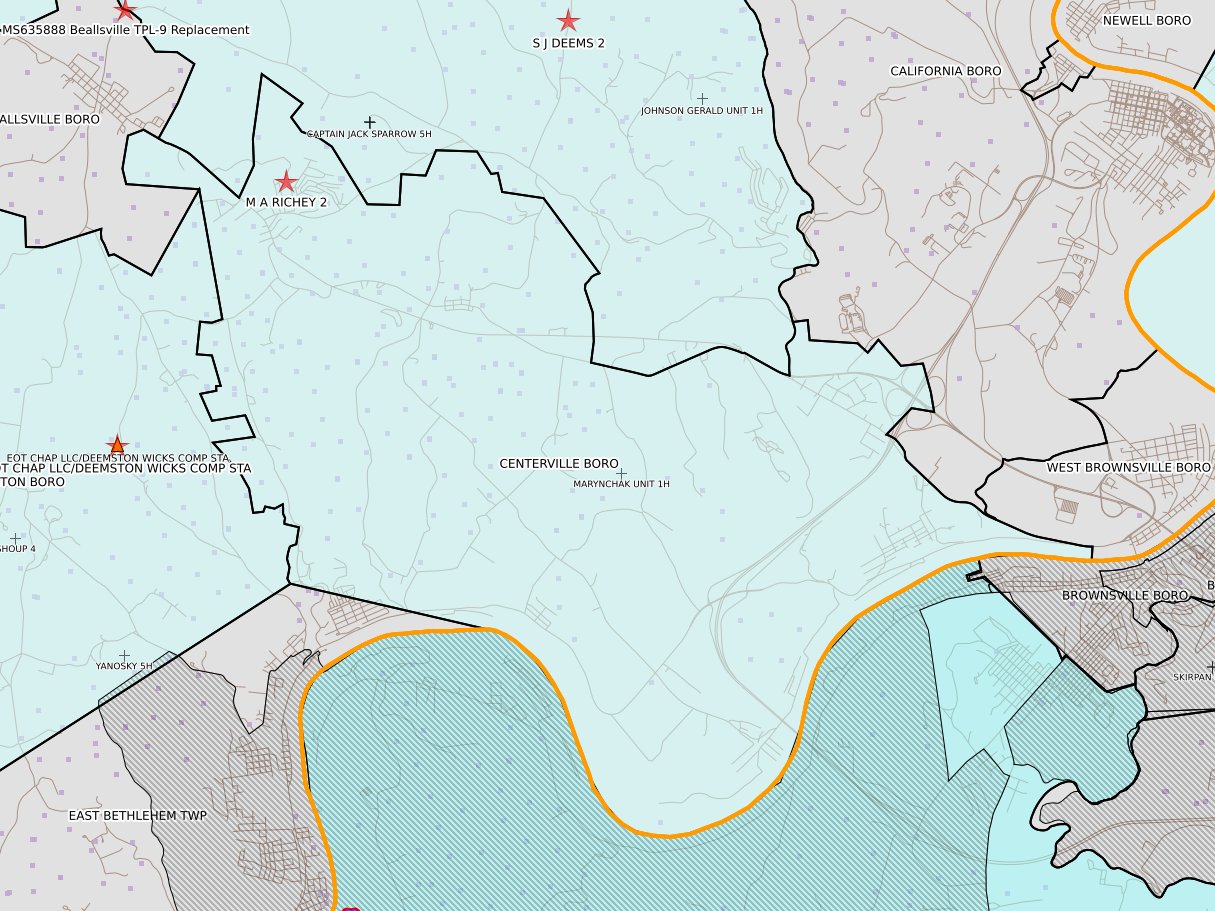
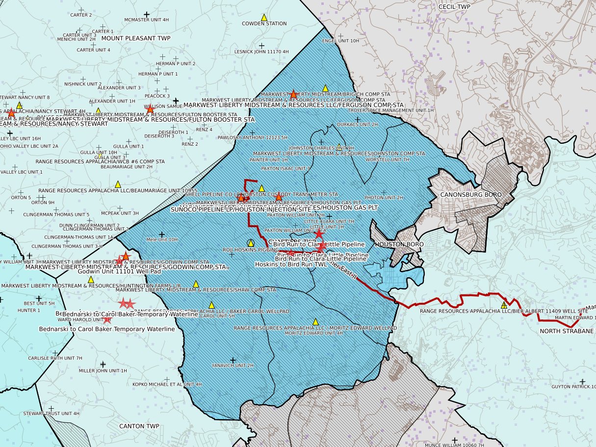
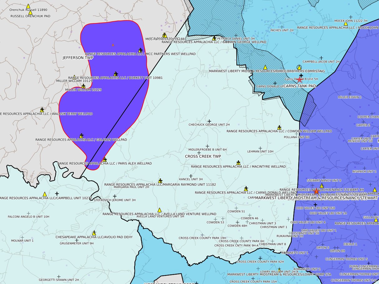
This report shows all DEP permits for Washington County that are either pending or "disposed" within the past 30 days. Disposed typically happens when a permit is issued; less often when a permit is withdrawn or (very very infrequently!) denied. The table of contents shows Oil & Gas related permits in full-sized type and boldface; other permits show in normal type and smaller size. Whether a permit is considered Oil & Gas related is determined mostly by an algorithm, which can be wrong. There is a manual override table for exceptions. If you believe the listing of Oil & Gas status is shown incorrectly, please send details using the Contact link at the top of this page. Please note that neither conventional wells nor natural gas distribution pipelines are excluded.
Not all permits are easy to geolocate; you will probably find cases where the municipality color coding does not agree with the number of red stars. Also, DEP's data is not always correct.
Click a map to
enlarge
 |
 |
 |
 |
|
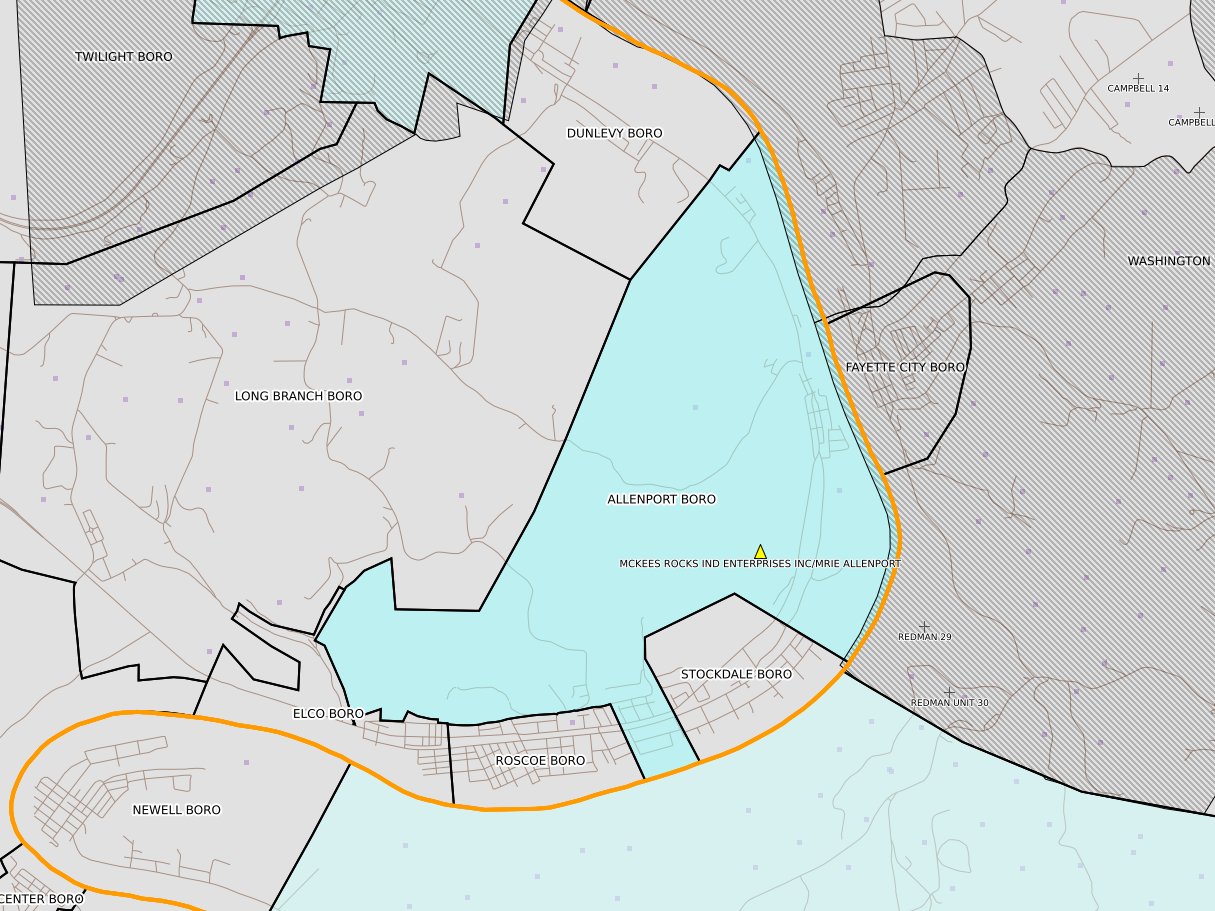
Allenport Boro
|
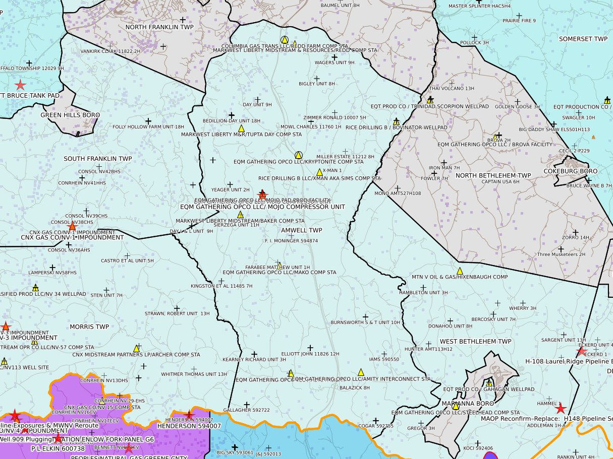
Amwell Twp
|
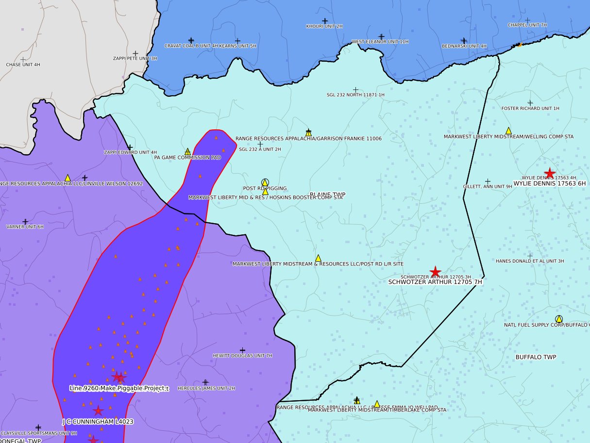
Blaine Twp
|
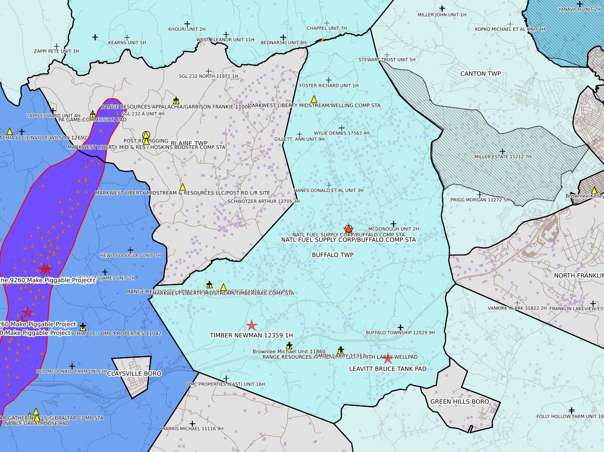
Buffalo Twp
|
 |
 |
 |
 |
|
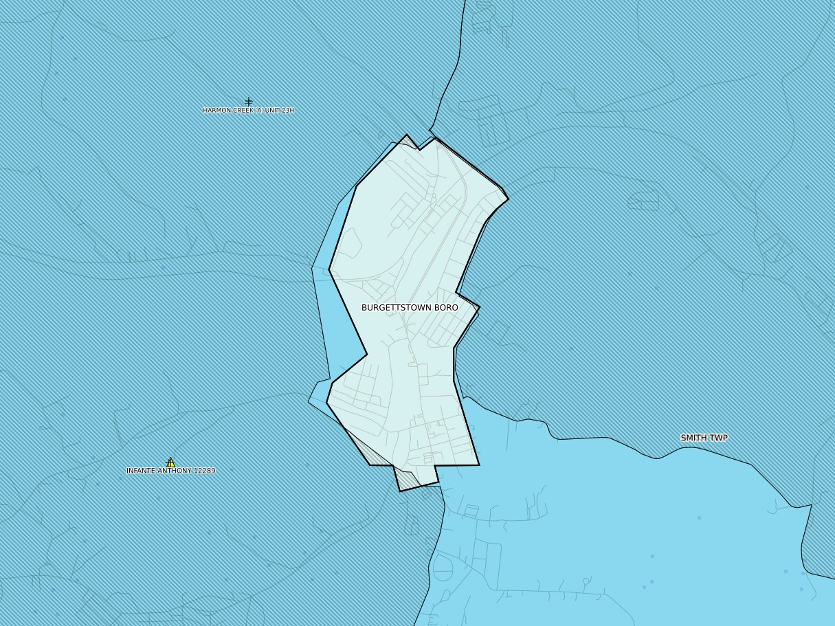
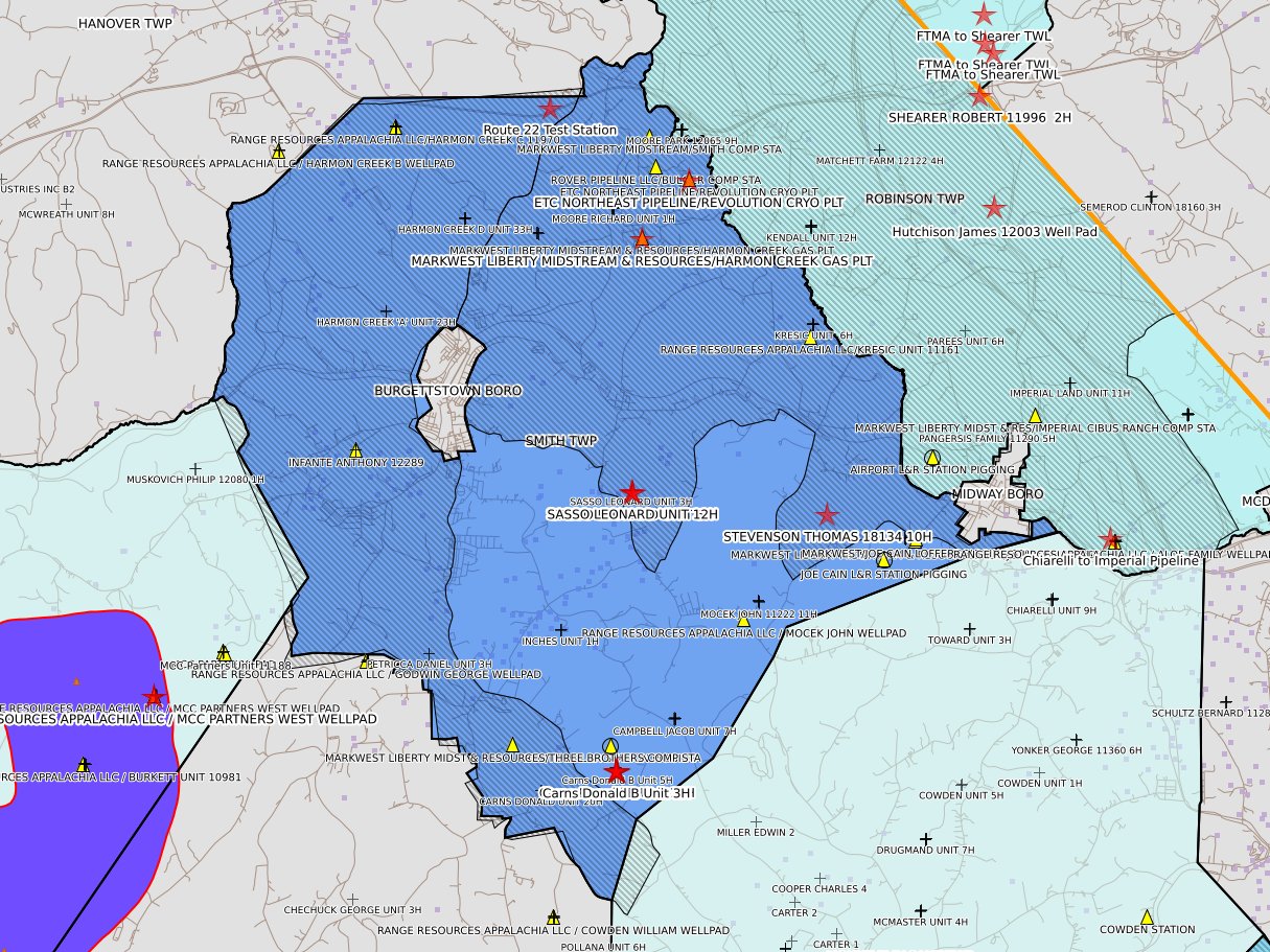
Burgettstown Boro
|
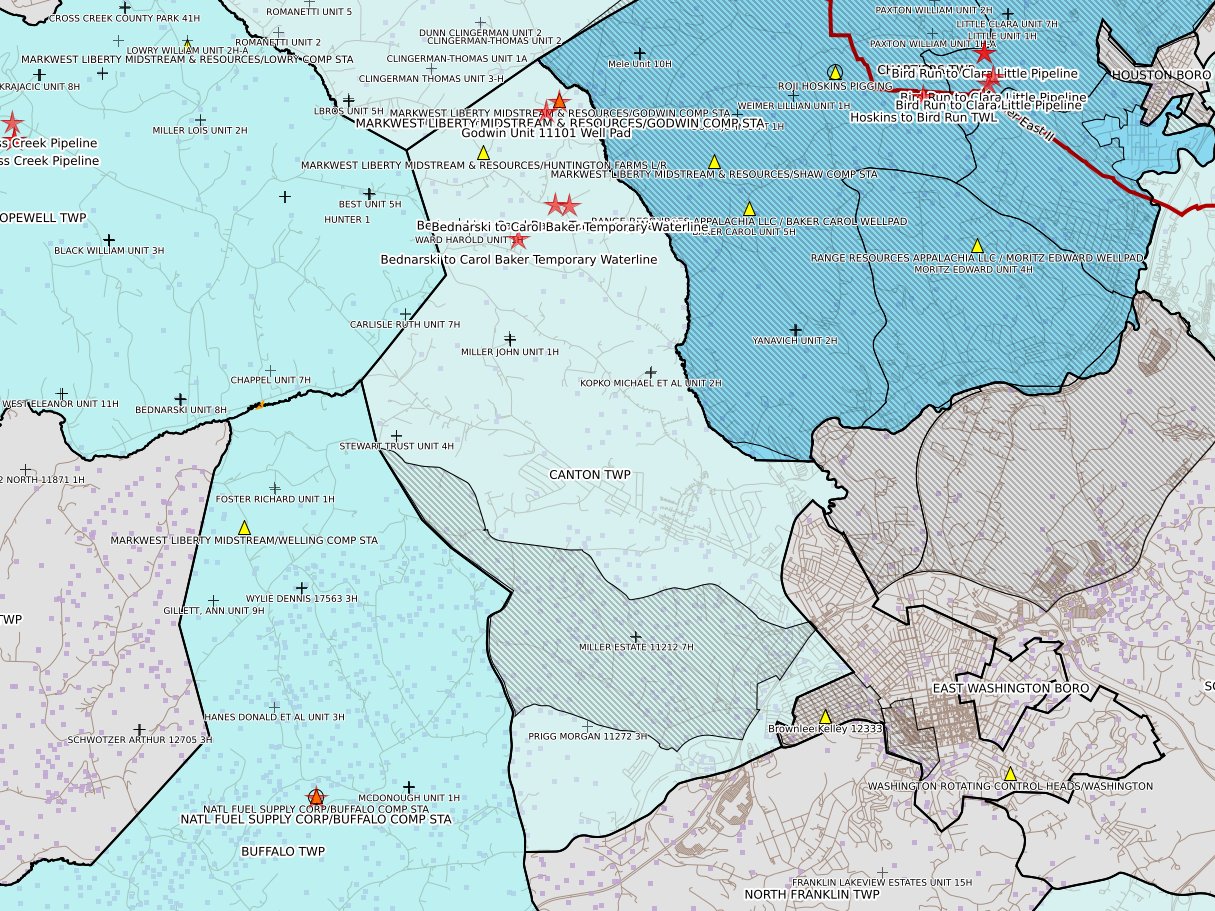
Canton Twp
|
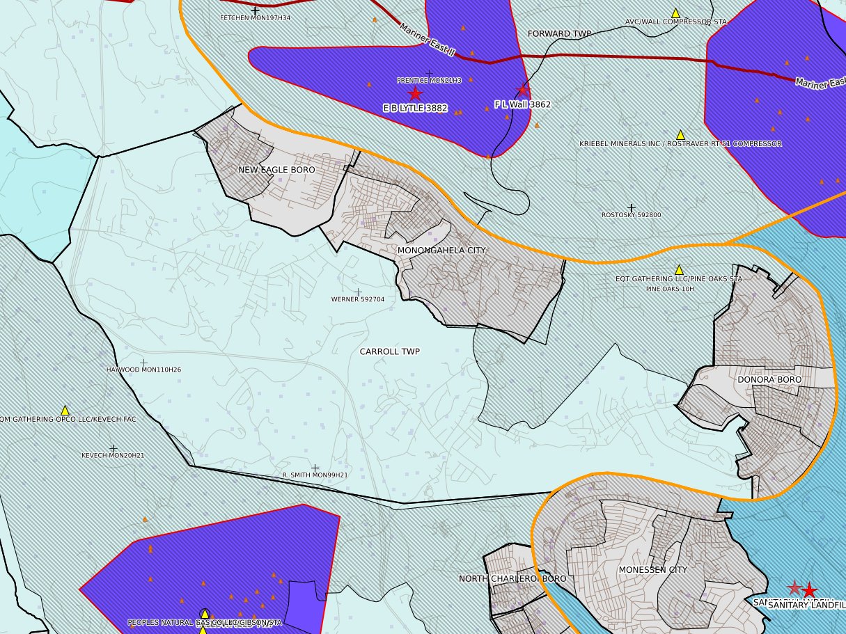
Carroll Twp
|
Cecil Twp
|
 |
 |
 |
 |
|
Centerville Boro
|
Chartiers Twp
|
Cross Creek Twp
|
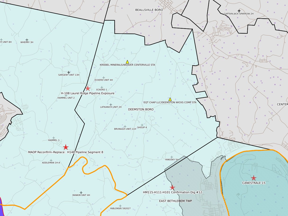
Deemston Boro
|
 |
 |
 |
 |
|
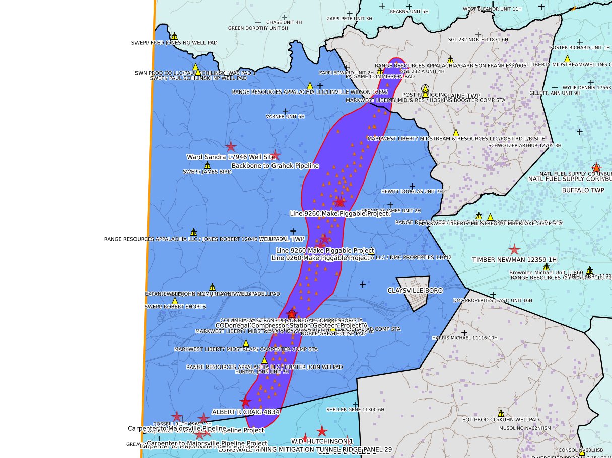
Donegal Twp
|
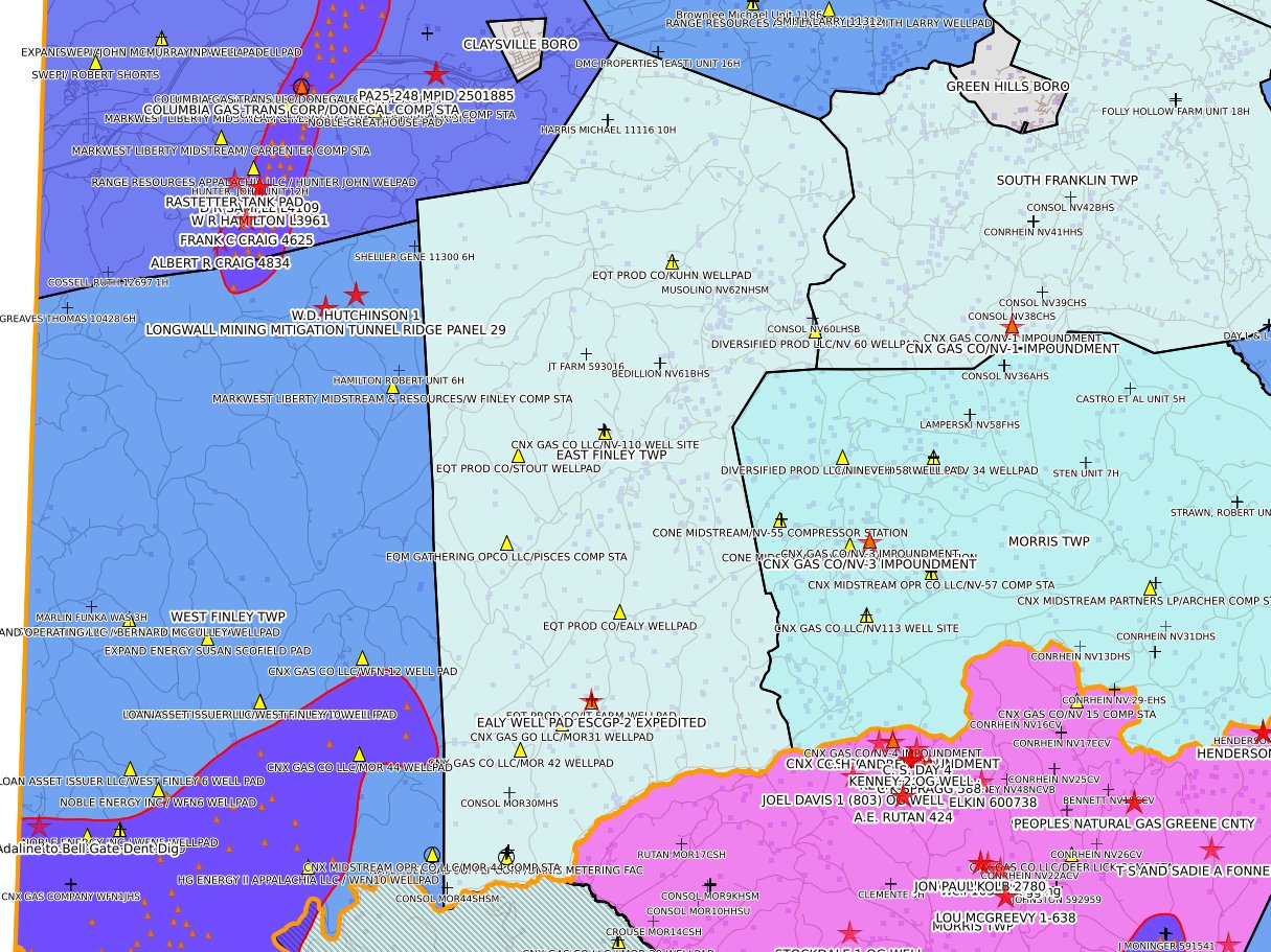
East Finley Twp
|
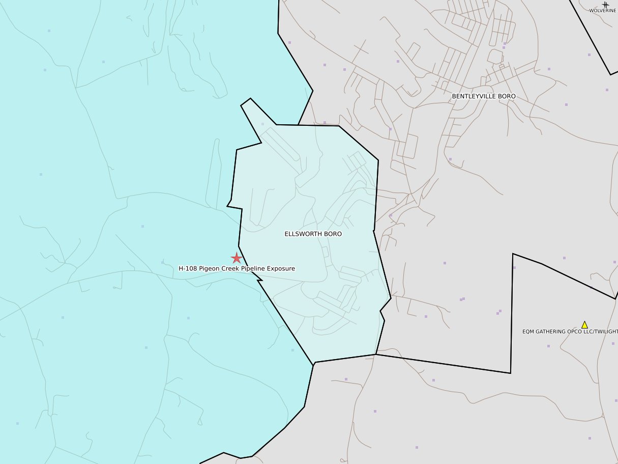
Ellsworth Boro
|
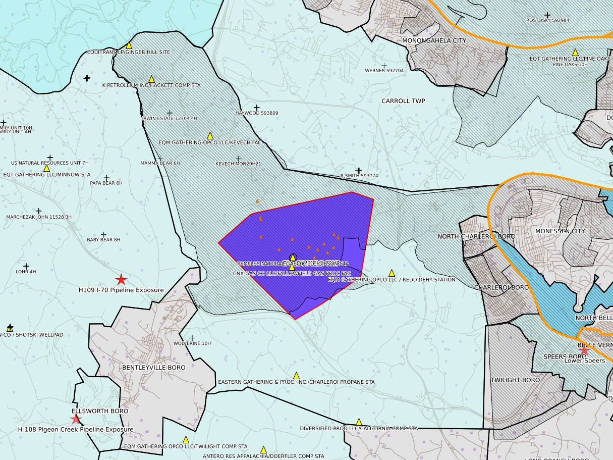
Fallowfield Twp
|
 |
 |
 |
 |
|
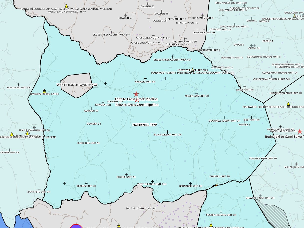
Hopewell Twp
|
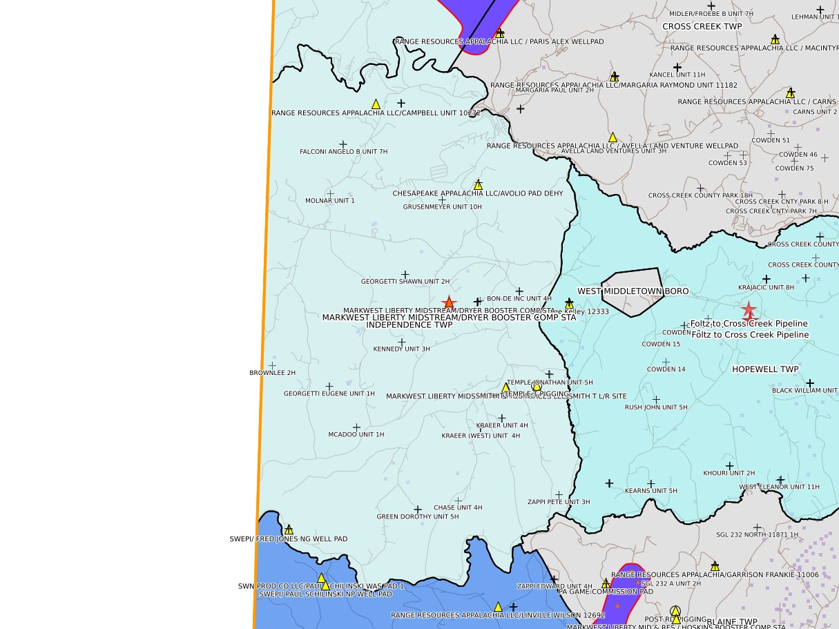
Independence Twp
|
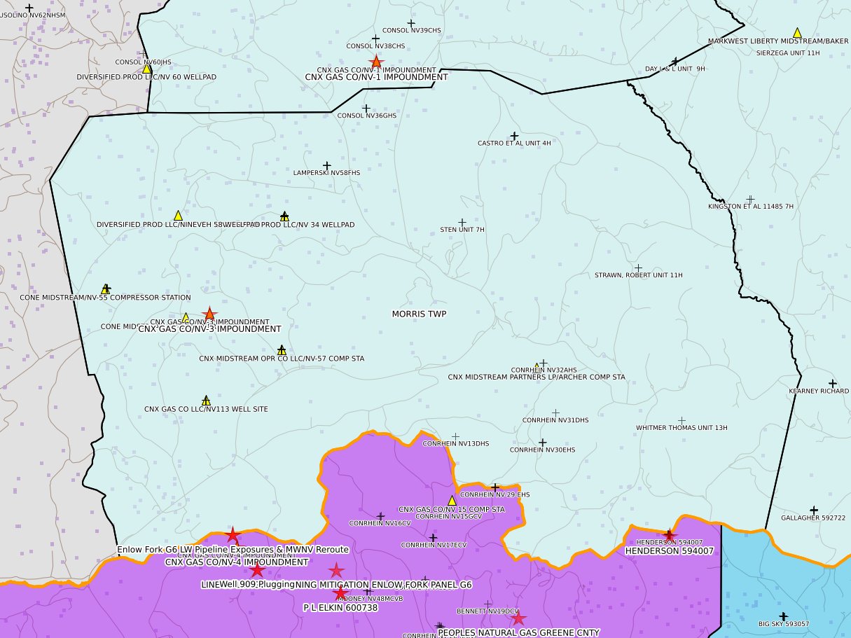
Morris Twp
|
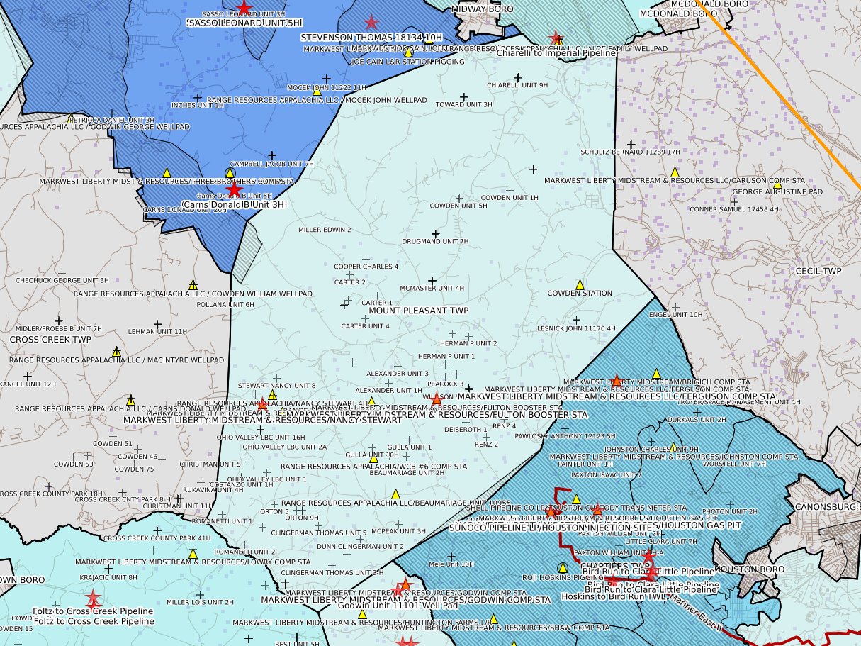
Mount Pleasant Twp
|
 |
 |
 |
 |
|
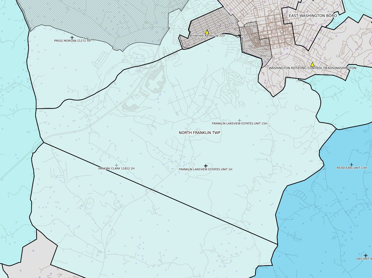
North Franklin Twp
|
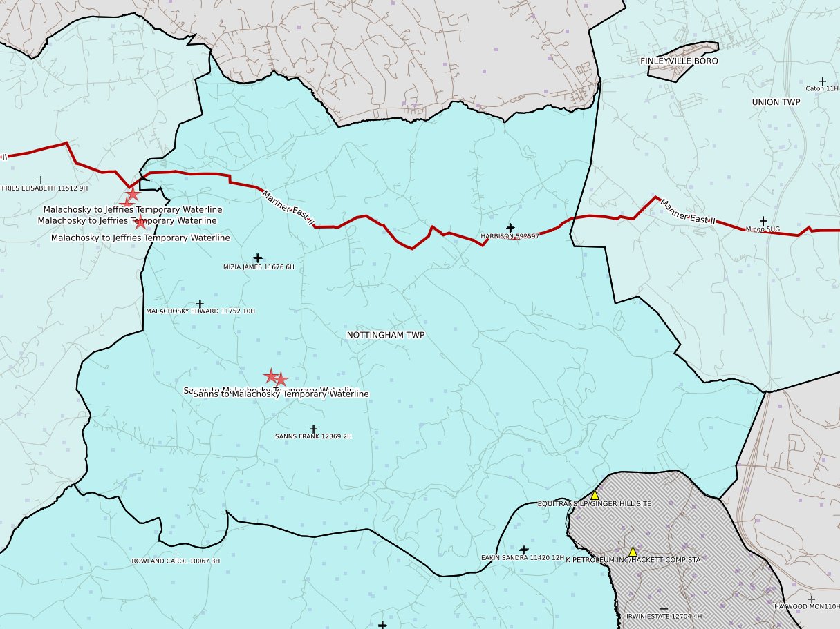
Nottingham Twp
|
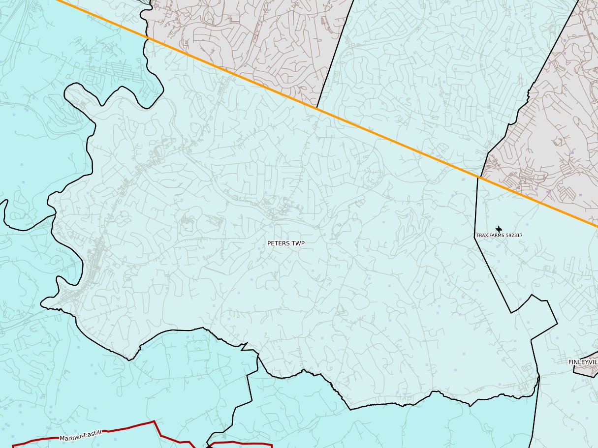
Peters Twp
|
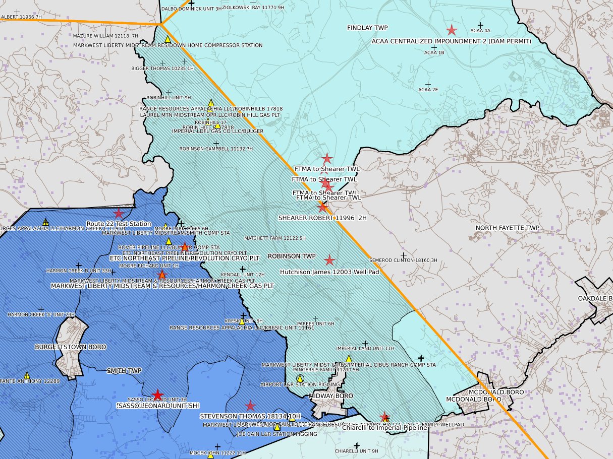
Robinson Twp
|
 |
 |
 |
 |
|
Smith Twp
|
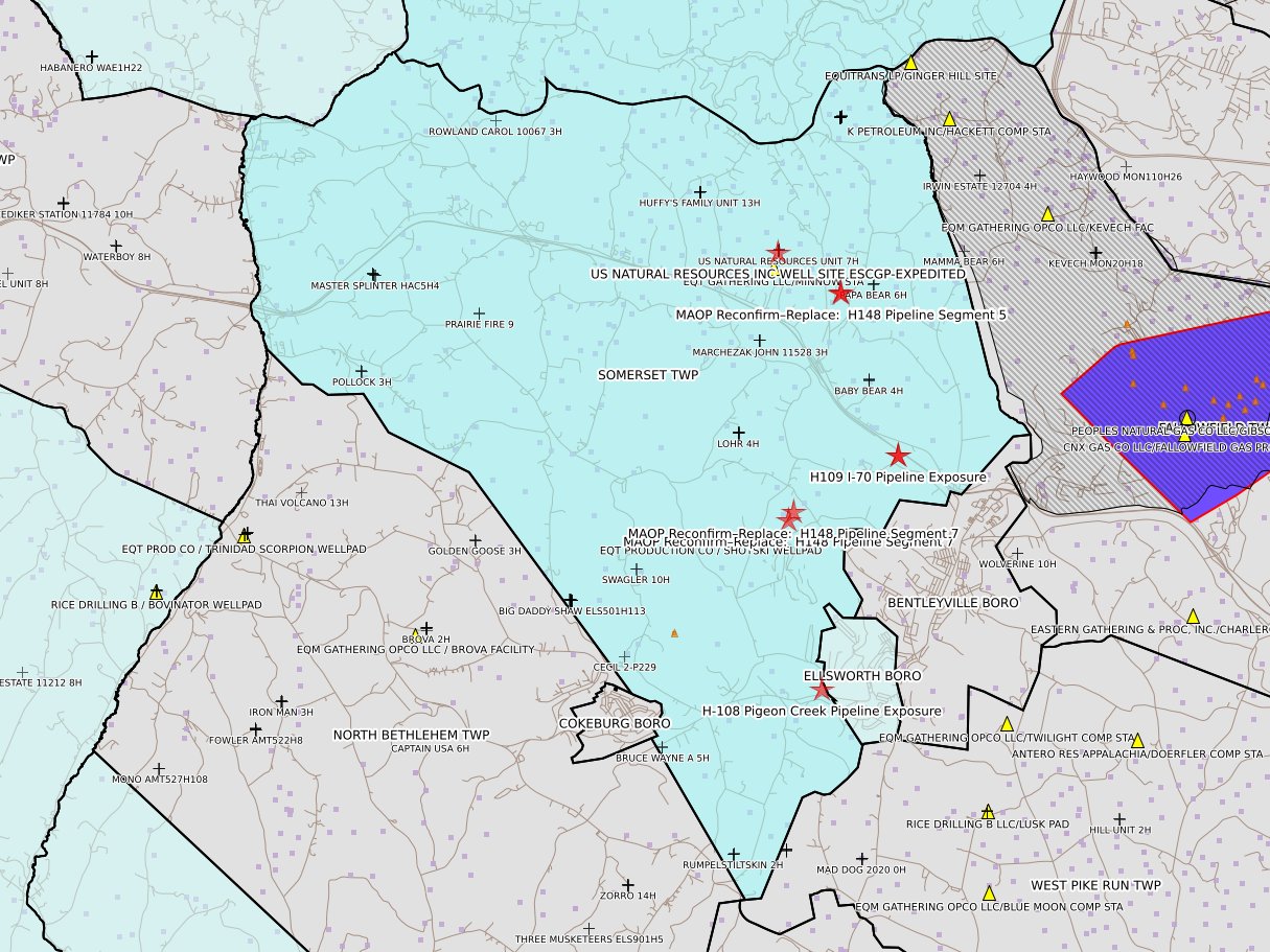
Somerset Twp
|
South Franklin Twp
|
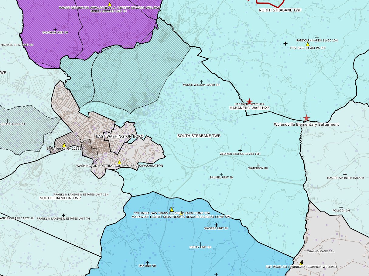
South Strabane Twp
|
 |
 |
||
|
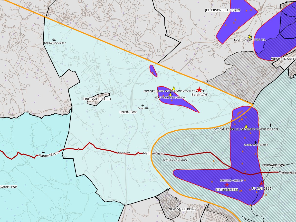
Union Twp
|
West Finley Twp
|