The Harmed Success Stories Concepts How To What Is Commentary
Pennsylvania Recent Oil & Gas Non-no-violation Inspection
Reports
Data Source: DEP Oil and Gas Compliance Report
<https://greenport.pa.gov/ReportExtracts/OG/OilComplianceReport>
Municipality color coding adds one to the count for every violation after the first one for that Inspection ID. I.e. if you download the Oil and Gas Compliance Report as a spreadsheet in CSV format, the municipality color coding counts the number of matching rows in the spreadsheet.
The Full Inspection Report links yield a zip file, which may include photographs and possibly PDF files giving the operators response to a Notice of Violation (if there is one). There should always be a PDF in the zip file with the formal inspection report, which may include photographs (if there are any) which may also be included separately in the zip file.
Data as of 2026-07-23 Municipality color coding adds one to the count for every violation after the first one for that Inspection ID. I.e. if you download the Oil and Gas Compliance Report as a spreadsheet in CSV format, the municipality color coding counts the number of matching rows in the spreadsheet.
The Full Inspection Report links yield a zip file, which may include photographs and possibly PDF files giving the operators response to a Notice of Violation (if there is one). There should always be a PDF in the zip file with the formal inspection report, which may include photographs (if there are any) which may also be included separately in the zip file.
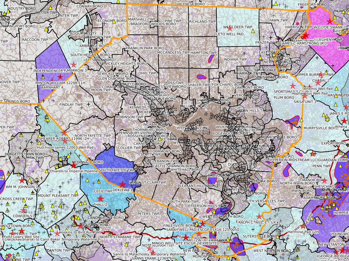
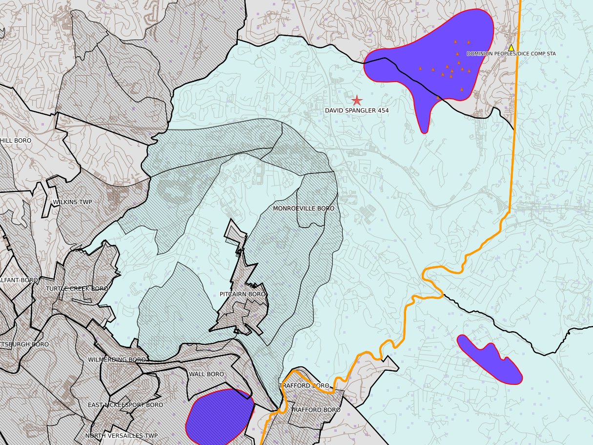
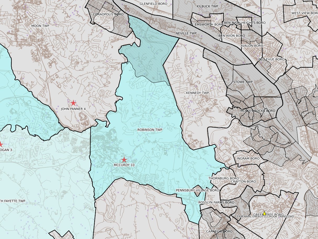
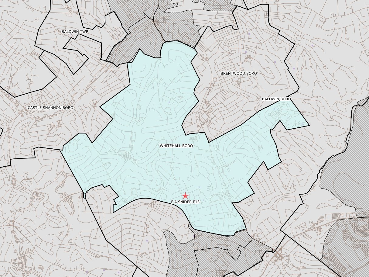
Allegheny
Compliance Schedule Evaluation of DAVID SPANGLER 454
Compliance Schedule Evaluation of CHOELLER 1
Compliance Schedule Evaluation of LORISH 1
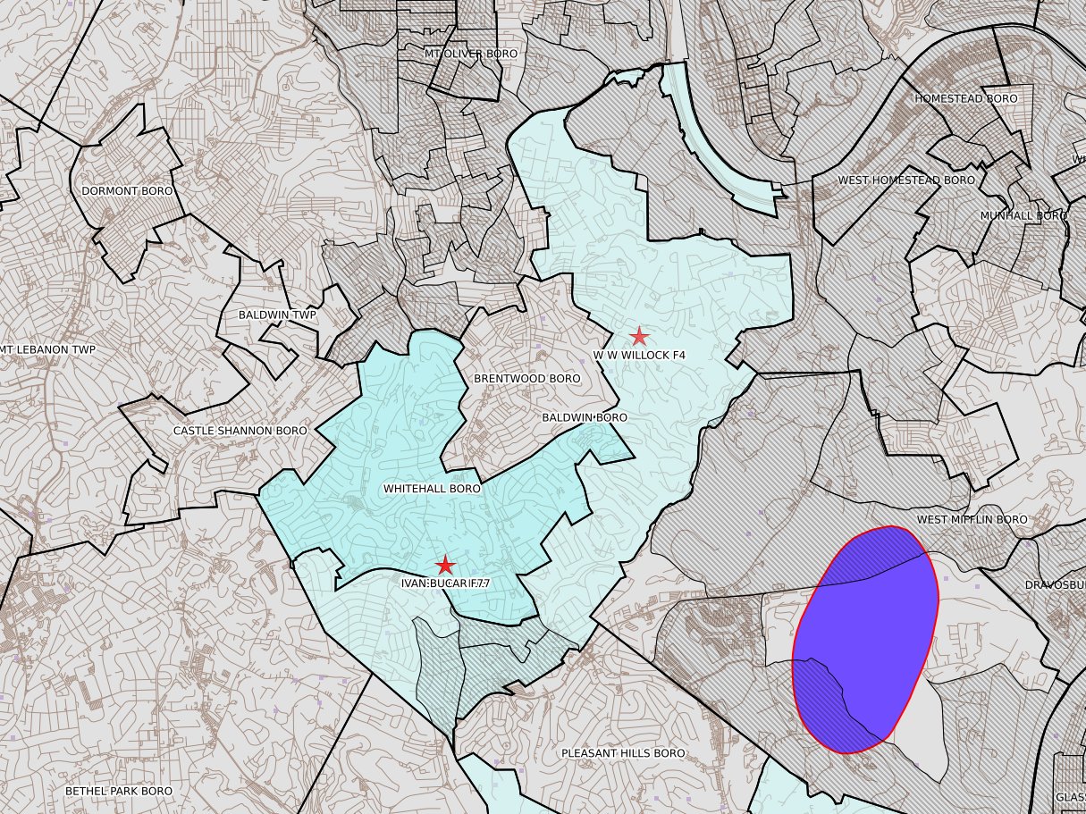
Routine/Complete Inspection of W W WILLOCK F4
Compliance Schedule Evaluation of DAVID SPANGLER 454
Routine/Complete Inspection of IVAN BUCAR F77
Compliance Schedule Evaluation of DAVID SPANGLER 454
Plugging(Includes Plugged/Mined Through) of E B LYTLE 3882
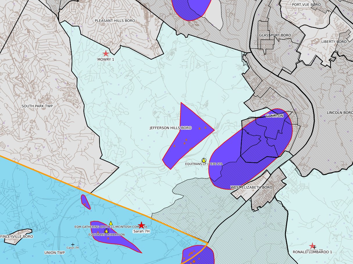
Administrative/File Review of MOWRY 1
Routine/Complete Inspection of HASKELL & DUPONT F9
Routine/Complete Inspection of F A SNIDER F13
Administrative/File Review of LETO WELL PAD
Compliance Schedule Evaluation of MUN. AUTH. OF WESTMORELAND COUNTY 3
Armstrong
Routine/Complete Inspection of Cooper to Jost Van Dyke ROW Project
Routine/Complete Inspection of Cooper to Jost Van Dyke ROW Project
Beaver
Site Restoration of ZAKUTNEY RUTH WELL SITE ESCGP ESX17-007-0009
Administrative/File Review of IVA FERGUSON 1
Bradford
Incident- Response to Accident or Event of BURKE 1HC
Administrative/File Review of WGC BRA 2H
Routine/Partial Inspection of A&M 104HC
Butler
Complaint Inspection of GE & RB FLANDREAU 160A 1
Routine/Complete Inspection of SCULPTOR 1-MH
Follow-up Inspection of KOZIK BROS CONST INC 2
Cambria
Site Restoration of B LOWMASTER UNIT 1
Follow-up Inspection of A J STAHURA 8
Compliance Schedule Evaluation of B LOWMASTER UNIT 1
Follow-up Inspection of A J STAHURA 8
Centre
Incident- Response to Accident or Event of STATE GAME LANDS NO 100 129
Clarion
Administrative/File Review of JOHNSON 1
Follow-up Inspection of MAHLE M12
Routine/Complete Inspection of HICKMAN LUMBER JP REED 5
Follow-up Inspection of DUNLAP 1 151
Clearfield
Incident- Response to Accident or Event of IRVIN (M-591) 658
Routine/Partial Inspection of GREEN GLEN CORP 4
Routine/Partial Inspection of DAVID ECKLUND 1
Routine/Partial Inspection of GREEN GLEN CORP 4
Clinton
Routine/Complete Inspection of WINNER 6 WELL PAD & WATER STORAGE IMPOUNDMENT
Routine/Complete Inspection of WINNER 2 PROJ
Routine/Complete Inspection of WINNER 1 PROJ
Routine/Complete Inspection of WINNER 4H WELL PAD
Crawford
Administrative/File Review of WILLIAMS 19
Plugging(Includes Plugged/Mined Through) of HEBERT 1
Plugging(Includes Plugged/Mined Through) of HEBERT 1
Plugging(Includes Plugged/Mined Through) of HEBERT 1
Administrative/File Review of HEBERT 1
Plugging(Includes Plugged/Mined Through) of ANDREWS 3
Plugging(Includes Plugged/Mined Through) of ANDREWS 3
Plugging(Includes Plugged/Mined Through) of WILLIAMS 19
Routine/Complete Inspection of WILSON 1
Routine/Complete Inspection of CUBBON LUMBER 3
Routine/Complete Inspection of WILSON SANFORD 1
Plugging(Includes Plugged/Mined Through) of WILLIAMS 19
Routine/Complete Inspection of RD GOURLEY 1
Routine/Complete Inspection of VINCENT E BYRNE 1
Routine/Complete Inspection of H WILSON WATSON ET UX 1
Routine/Complete Inspection of WATSON UNIT 2
Plugging(Includes Plugged/Mined Through) of WILLIAMS 19
Administrative/File Review of WARREN 3
Administrative/File Review of ANDREWS 3
Routine/Complete Inspection of VERNON A BISH ET UX 1
Routine/Complete Inspection of ARTHUR H REICHEL 1
Routine/Complete Inspection of JAMES FIORETTI 1
Routine/Complete Inspection of ERNEST B SHREVE 1
Follow-up Inspection of JOSEPH W MILLER 2
Routine/Complete Inspection of BARRY & CONNIE GREELEY 1
Routine/Complete Inspection of BLY R 3
Routine/Complete Inspection of R BLY 2
Plugging(Includes Plugged/Mined Through) of WILLIAMS 19
Administrative/File Review of YODER UNIT 11
Elk
Follow-up Inspection of HM8 WT 3261 PAT
Erie
Plugging(Includes Plugged/Mined Through) of KIBBE 4
Plugging(Includes Plugged/Mined Through) of KIBBE 4
Administrative/File Review of NORTHEAST CHRISTIAN & MISSIONARY ALL 1
Plugging(Includes Plugged/Mined Through) of KIBBE 4
Administrative/File Review of KIBBE 4
Routine/Partial Inspection of WILLIAM & DOROTHY ROSECRANS 1
Routine/Complete Inspection of ALBION AREA SPORTMANS CLUB 1
Plugging(Includes Plugged/Mined Through) of KIBBE 4
Administrative/File Review of GARY SILVIA J & NORMAN TROYER 2
Routine/Complete Inspection of NORTHEAST CHRISTIAN & MISSIONARY ALL 1
Routine/Complete Inspection of JOHN D UX REBECCA A NEWTON 1
Administrative/File Review of NORMAN & MERVIN TROYER 3
Administrative/File Review of BEVERLY J HOPKINS 1
Routine/Complete Inspection of BEVERLY J HOPKINS 1
Routine/Complete Inspection of WALTER GRIBBLE 1
Follow-up Inspection of KENNETH A & SHIRLEY A WISE 3
Follow-up Inspection of EDWARD BERNRITTER 1
Routine/Complete Inspection of CARLTON & PHYLLISS PATTISON 1
Routine/Complete Inspection of CARLTON V PATTISON 3
Complaint Inspection of LAKEPORT REALTY 1
Fayette
Compliance Schedule Evaluation of WILSON 5
Compliance Schedule Evaluation of CHELLINI 1
Administrative/File Review of HILLEN 1
Compliance Schedule Evaluation of C SAVAGE 2
Compliance Schedule Evaluation of WILSON 5
Compliance Schedule Evaluation of CONN 1
Compliance Schedule Evaluation of ELLIOTT 11
Compliance Schedule Evaluation of C SAVAGE 2
Follow-up Inspection of SWIANTEK 1
Compliance Schedule Evaluation of CONN 1
Administrative/File Review of BIRD 1
Compliance Schedule Evaluation of J R HARRIS 670931
Routine/Complete Inspection of J R HARRIS 670931
Compliance Schedule Evaluation of E D SMELL 670673
Compliance Schedule Evaluation of ELLIOTT 11
Compliance Schedule Evaluation of C SAVAGE 2
Compliance Schedule Evaluation of WILSON 5
Compliance Schedule Evaluation of RAFAIL/GRIMM 4
Administrative/File Review of HILLEN 1
Compliance Schedule Evaluation of HILLEN 1
Compliance Schedule Evaluation of PATTERSON 7
Compliance Schedule Evaluation of ELLIOTT 11
Compliance Schedule Evaluation of C SAVAGE 2
Compliance Schedule Evaluation of SPROUL 7005
Compliance Schedule Evaluation of HOLCHIN 2
Compliance Schedule Evaluation of WILSON 5
Compliance Schedule Evaluation of CHELLINI 1
Compliance Schedule Evaluation of MAWC 7020 1H
Compliance Schedule Evaluation of J R HARRIS 670931
Compliance Schedule Evaluation of MAWC 7020 3H
Compliance Schedule Evaluation of BIRD 1
Compliance Schedule Evaluation of ELLIOTT 11
Follow-up Inspection of DEBORD 5
Compliance Schedule Evaluation of DEBORD 5
Follow-up Inspection of HOLCHIN 2
Administrative/File Review of PRITTS UNIT 1
Administrative/File Review of GABONAY NATIONAL CITY BANK 6
Compliance Schedule Evaluation of C SAVAGE 2
Follow-up Inspection of HILLEN 1
Compliance Schedule Evaluation of CHELLINI 1
Follow-up Inspection of RITTER UNIT 5H
Compliance Schedule Evaluation of HILLEN 1
Follow-up Inspection of HILLEN 1
Forest
Follow-up Inspection of DR02 PAD & IMPOUNDMENT ESX
Greene
Compliance Schedule Evaluation of J.H. ORNDORFF 3
Compliance Schedule Evaluation of KELLEY 5A
Compliance Schedule Evaluation of FRANK ULLOM 3
Compliance Schedule Evaluation of FRANK ULLOM 1
Compliance Schedule Evaluation of TIMOTHY E & NANCY HORR 2
Incident- Response to Accident or Event of NIDBH015 Waterline
Site Restoration Extension of TIMOTHY E & NANCY HORR 2
Compliance Schedule Evaluation of FRANK ULLOM 3
Administrative/File Review of Richter Impoundment Reclamation
Compliance Schedule Evaluation of Richter Impoundment Reclamation
Compliance Schedule Evaluation of Richter Impoundment Reclamation
Compliance Schedule Evaluation of Richter Impoundment Reclamation
Compliance Schedule Evaluation of Richter Impoundment Reclamation
Compliance Schedule Evaluation of MENHART UNIT 1
Compliance Schedule Evaluation of MCVAY 1
Compliance Schedule Evaluation of Richter Impoundment Reclamation
Compliance Schedule Evaluation of Richter Impoundment Reclamation
Compliance Schedule Evaluation of Richter Impoundment Reclamation
Compliance Schedule Evaluation of Richter Impoundment Reclamation
Compliance Schedule Evaluation of Richter Impoundment Reclamation
Incident- Response to Accident or Event of Richter Impoundment Reclamation
Incident- Response to Accident or Event of PAYJTW001 Project
Compliance Schedule Evaluation of FRANK ULLOM 3
Compliance Schedule Evaluation of O O GRIMES 3603
Compliance Schedule Evaluation of FRANK ULLOM 3
Compliance Schedule Evaluation of W.H. DYE 2
Compliance Schedule Evaluation of Richter Impoundment Reclamation
Compliance Schedule Evaluation of Richter Impoundment Reclamation
Compliance Schedule Evaluation of Richter Impoundment Reclamation
Compliance Schedule Evaluation of Richter Impoundment Reclamation
Follow-up Inspection of FOX HILL 1
Compliance Schedule Evaluation of Richter Impoundment Reclamation
Administrative/File Review of CLUTTER 709-2
Incident- Response to Accident or Event of Richter Impoundment Reclamation
Follow-up Inspection of Richter Impoundment Reclamation
Follow-up Inspection of Richter Impoundment Reclamation
Follow-up Inspection of Richter Impoundment Reclamation
Administrative/File Review of Swarts and Hunters Cave Well Replacement Project
Administrative/File Review of Patterson Valve Yard
Incident- Response to Accident or Event of Richter Impoundment Reclamation
Compliance Schedule Evaluation of J.H. ORNDORFF 1
Compliance Schedule Evaluation of J.H. ORNDORFF 2
Incident- Response to Accident or Event of Richter Impoundment Reclamation
Preoperation Inspection of Foley 1HG
Preoperation Inspection of Downer 7H
Indiana
Routine/Complete Inspection of Cooper to Jost Van Dyke ROW Project
Routine/Complete Inspection of Cooper to Jost Van Dyke ROW Project
Jefferson
Incident- Response to Accident or Event of LEE SPANGLER 4
Administrative/File Review of DAVID A WEAVER 1
Lawrence
Administrative/File Review of CAMP ELLIOTT 1 OG WELL
Administrative/File Review of PULASKI WHITING 1
Plugging(Includes Plugged/Mined Through) of PULASKI WHITING 1
Administrative/File Review of PULASKI WHITING 1
Plugging(Includes Plugged/Mined Through) of PULASKI WHITING 1
Plugging(Includes Plugged/Mined Through) of PULASKI WHITING 1
Plugging(Includes Plugged/Mined Through) of PULASKI WHITING 1
Administrative/File Review of PULASKI WHITING 1
Plugging(Includes Plugged/Mined Through) of PULASKI WHITING 1
Plugging(Includes Plugged/Mined Through) of PULASKI WHITING 1
Plugging(Includes Plugged/Mined Through) of PULASKI WHITING 1
Plugging(Includes Plugged/Mined Through) of PULASKI WHITING 1
Plugging(Includes Plugged/Mined Through) of PULASKI WHITING 1
Plugging(Includes Plugged/Mined Through) of PULASKI WHITING 1
McKean
Routine/Complete Inspection of LOT 221 52
Incident- Response to Accident or Event of WT 4912 8
Follow-up Inspection of JACK 16
Mercer
Plugging(Includes Plugged/Mined Through) of R D EPERTHENER 2542
Plugging(Includes Plugged/Mined Through) of FIRTH 2
Plugging(Includes Plugged/Mined Through) of MOOSE 1
Plugging(Includes Plugged/Mined Through) of FIRTH 2
Plugging(Includes Plugged/Mined Through) of FIRTH 2
Administrative/File Review of FIRTH 2
Administrative/File Review of MOOSE 1
Plugging(Includes Plugged/Mined Through) of MOOSE 1
Plugging(Includes Plugged/Mined Through) of MOOSE 1
Plugging(Includes Plugged/Mined Through) of MOOSE 1
Administrative/File Review of MOOSE 1
Plugging(Includes Plugged/Mined Through) of MOOSE 1
Administrative/File Review of MOOSE 1
Plugging(Includes Plugged/Mined Through) of MOOSE 1
Administrative/File Review of MOOSE 1
Administrative/File Review of FIRTH 2
Administrative/File Review of WATSON 2
Plugging(Includes Plugged/Mined Through) of MOOSE 1
Plugging(Includes Plugged/Mined Through) of MOOSE 1
Plugging(Includes Plugged/Mined Through) of MOOSE 1
Administrative/File Review of MOOSE 1
Administrative/File Review of WATSON 2
Susquehanna
Routine/Complete Inspection of KUPSCZNK UNIT B 3H
Routine/Complete Inspection of KUPSCZNK UNIT B 2H
Routine/Complete Inspection of KUPSCZNK UNIT B 1H
Routine/Complete Inspection of MARBAKER 103HC
Incident- Response to Accident or Event of Conboy Pad
Incident- Response to Accident or Event of BLAISURE, JEAN PAD 2
Tioga
Routine/Complete Inspection of Whispering Pines Rod and Gun Club 7H
Routine/Complete Inspection of Whispering Pines Rod and Gun Club 12H
Routine/Complete Inspection of Whispering Pines Rod and Gun Club 10H
Routine/Complete Inspection of Whispering Pines Rod and Gun Club 8H
Routine/Complete Inspection of Whispering Pines Rod and Gun Club 4H
Follow-up Inspection of ENDLESS MTN ENERGY SGL 268
Administrative/File Review of Taft 109HU 53814
Venango
Follow-up Inspection of LOWER RENO 1A
Follow-up Inspection of LOWER RENO 1A
Follow-up Inspection of LOWER RENO 1A
Warren
Incident- Response to Accident or Event of LOT 740 15
Washington
Administrative/File Review of Pawlosky to Fulton Pipeline
Administrative/File Review of KEARNS UNIT 6H
Administrative/File Review of KEARNS UNIT 2H
Administrative/File Review of Jaybird Impoundment Reclamation
Administrative/File Review of JOHNSTON CHARLES UNIT 5H OG WELL
Follow-up Inspection of JAMES ARTHUR 064-2
Incident- Response to Accident or Event of WFN6HS WELL SITE ESCGP-EXPEDITED
Compliance Schedule Evaluation of S J DEEMS 2
Administrative/File Review of Jaybird Impoundment Reclamation
Incident- Response to Accident or Event of WFN6HS WELL SITE ESCGP-EXPEDITED
Incident- Response to Accident or Event of WFN6HS WELL SITE ESCGP-EXPEDITED
Incident- Response to Accident or Event of WFN6HS WELL SITE ESCGP-EXPEDITED
Incident- Response to Accident or Event of WFN6HS WELL SITE ESCGP-EXPEDITED
Follow-up Inspection of PAWLOSKY ANTHONY 12123 1H
Follow-up Inspection of EALY WELL PAD ESCGP-2 EXPEDITED
Site Restoration of A R GREIG L4836
Routine/Complete Inspection of S J DEEMS 2
Compliance Schedule Evaluation of JONES ROBERT 12046 6H
Compliance Schedule Evaluation of JONES ROBERT 12046 7H
Compliance Schedule Evaluation of JONES ROBERT 12046 8H
Compliance Schedule Evaluation of JONES ROBERT 12046 9H
Incident- Response to Accident or Event of Jaybird Impoundment Reclamation
Administrative/File Review of A R GREIG L4836
Administrative/File Review of PAWLOSKY ANTHONY 12123 5H
Incident- Response to Accident or Event of PAWLOSKY ANTHONY 12123 1H
Site Restoration of AVOLIO WELL PAD AND IMPOUNDMENTS ESCGP-2 EXPEDITED
Site Restoration of JONES ROBERT 12046 3H
Routine/Complete Inspection of GUY AVOLIO 6H
Incident- Response to Accident or Event of MOCEK JOHN 11222 12H
Compliance Schedule Evaluation of JAS R FAWCETT 3813
Administrative/File Review of MOCEK JOHN 11222 12H
Compliance Schedule Evaluation of JAS R FAWCETT 3813
Follow-up Inspection of MCLVAINE 1-P026
Follow-up Inspection of A R GREIG L4836
Follow-up Inspection of JOHNSON GERALD UNIT 4H
Follow-up Inspection of COWDEN 11
Follow-up Inspection of COWDEN 6H
Administrative/File Review of A R GREIG L4836
Compliance Schedule Evaluation of WM M. JOHNSON 1
Follow-up Inspection of FARRAH 1
Administrative/File Review of HUNTER AMT113H1
Follow-up Inspection of WM M. JOHNSON 1
Administrative/File Review of MCLVAINE 1-P026
Follow-up Inspection of COWDEN 9H OG WELL
Westmoreland
Follow-up Inspection of SCHIMIZZI S&M 1
Follow-up Inspection of SCHIMIZZI S&M 1
Follow-up Inspection of KEPPLE 4H
Administrative/File Review of MUNICIPAL AUTHORITY 1
Administrative/File Review of MAM14_U1 Pipeline and Waterline
Follow-up Inspection of JAMES E POWERS 1
Administrative/File Review of CORBETT 1
Administrative/File Review of CORBETT 3
Follow-up Inspection of ACKERMAN 2
Compliance Schedule Evaluation of ACKERMAN 2
Compliance Schedule Evaluation of S J ANDERSON 1
Administrative/File Review of R R MCQUILKEN 3
Compliance Schedule Evaluation of R R MCQUILKEN 3
Follow-up Inspection of MUNICIPAL AUTHORITY 1
Follow-up Inspection of MARY KUNKLE 5
Administrative/File Review of PAUL W GRAFF FMLY WYATT SEANOR COAL 4
Administrative/File Review of VALLEY GREEN 5
Administrative/File Review of Artemis Well Pad
Administrative/File Review of GUARDIAN COMPRESSOR STATION
Administrative/File Review of Aphrodite 6M
Administrative/File Review of WM MARTIN 1
Routine/Complete Inspection of ANDREW STROSKO 1
Wyoming
Routine/Partial Inspection of CAPPUCCI 4H
Routine/Partial Inspection of CAPPUCCI 102H
Allegheny