The Harmed Success Stories Concepts How To What Is Commentary
Pennsylvania Recent Oil & Gas Electronic Drilling Notifications
Data Source: DEP Oil and Gas Electronic Notifications
<http://cedatareporting.pa.gov/Reportserver/Pages/ReportViewer.aspx?/Public/DEP/OG/SSRS/OG_Notifications>
Notes: Stimulation is the industry term for fracking in the strict sense, i.e. the actual injection of material under hydraulic pressure.
Entries may contain notification of readiness for horizontal drilling of natural gas distribution line pipelines.
As-of date reflects the most recently sent notification as of when data for the report was pulled from the DEP.
Data as of 2026-07-13 Notes: Stimulation is the industry term for fracking in the strict sense, i.e. the actual injection of material under hydraulic pressure.
Entries may contain notification of readiness for horizontal drilling of natural gas distribution line pipelines.
As-of date reflects the most recently sent notification as of when data for the report was pulled from the DEP.
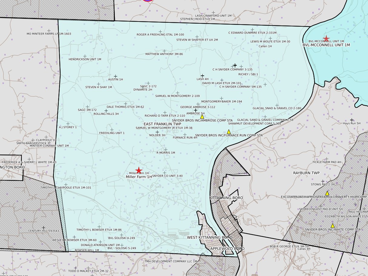
Armstrong
[NOTIFICATION]: Casing cementing notification 58 Pa. C.S. 3211(f)(2) for well API 37-005-31563-00-00 for Garretts Run 4H
[NOTIFICATION]: Drilling resumption After Break of 30 days or more notification 58 Pa. C.S. 3211(f)(1) for well API 37-005-31563-00-00 for Garretts Run 4H
[NOTIFICATION]: Drilling resumption After Break of 30 days or more notification 58 Pa. C.S. 3211(f)(1) for well API 37-005-31543-00-00 for Dynamite 8H
[NOTIFICATION]: Casing cementing notification 58 Pa. C.S. 3211(f)(2) for well API 37-005-31542-00-00 for Dynamite 7H
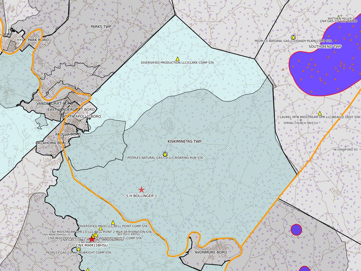
[NOTIFICATION]: Abandonment or plugging notification 58 Pa. C.S. 3211(f)(2) for well API 37-005-00777-00-00 for S H BOLLINGER 1
[NOTIFICATION]: Casing cementing notification 58 Pa. C.S. 3211(f)(2) for well API 37-005-31564-00-00 for Garretts Run 5H
[NOTIFICATION]: Drilling resumption After Break of 30 days or more notification 58 Pa. C.S. 3211(f)(1) for well API 37-005-31564-00-00 for Garretts Run 5H
[NOTIFICATION]: Drilling resumption After Break of 30 days or more notification 58 Pa. C.S. 3211(f)(1) for well API 37-005-31542-00-00 for Dynamite 7H
[NOTIFICATION]: Casing cementing notification 58 Pa. C.S. 3211(f)(2) for well API 37-005-31541-00-00 for Dynamite 6H
[NOTIFICATION]: Stimulation notification 58 Pa. C.S. 3211(f)(2) for well API 37-005-31530-00-00 for Frosty Mug 10H
[NOTIFICATION]: Stimulation notification 58 Pa. C.S. 3211(f)(2) for well API 37-005-31529-00-00 for Frosty Mug 9H
[NOTIFICATION]: Stimulation notification 58 Pa. C.S. 3211(f)(2) for well API 37-005-31528-00-00 for Frosty Mug 8H
[NOTIFICATION]: Stimulation notification 58 Pa. C.S. 3211(f)(2) for well API 37-005-31527-00-00 for Frosty Mug 7H
[NOTIFICATION]: Stimulation notification 58 Pa. C.S. 3211(f)(2) for well API 37-005-31526-00-00 for Frosty Mug 6H
[NOTIFICATION]: Pressure test notification 58 Pa. C.S. 3211(f)(2) for well API 37-005-31530-00-00 for Frosty Mug 10H
[NOTIFICATION]: Pressure test notification 58 Pa. C.S. 3211(f)(2) for well API 37-005-31529-00-00 for Frosty Mug 9H
[NOTIFICATION]: Pressure test notification 58 Pa. C.S. 3211(f)(2) for well API 37-005-31528-00-00 for Frosty Mug 8H
[NOTIFICATION]: Pressure test notification 58 Pa. C.S. 3211(f)(2) for well API 37-005-31527-00-00 for Frosty Mug 7H
[NOTIFICATION]: Pressure test notification 58 Pa. C.S. 3211(f)(2) for well API 37-005-31526-00-00 for Frosty Mug 6H
[NOTIFICATION]: Drilling resumption After Break of 30 days or more notification 58 Pa. C.S. 3211(f)(1) for well API 37-005-31541-00-00 for Dynamite 6H
[NOTIFICATION]: Casing cementing notification 58 Pa. C.S. 3211(f)(2) for well API 37-005-31540-00-00 for Dynamite 5H
[NOTIFICATION]: Abandonment or plugging notification 58 Pa. C.S. 3211(f)(2) for well API 37-005-30832-00-00 for COLLIER-TREGASKES UNIT 1M
Beaver
[NOTIFICATION]: Stimulation notification 58 Pa. C.S. 3211(f)(2) for well API 37-007-20657-00-00 for MINTON WILLIAM 12298 15H
[NOTIFICATION]: Stimulation notification 58 Pa. C.S. 3211(f)(2) for well API 37-007-20703-00-00 for MINTON WILLIAM 12298 14H
[NOTIFICATION]: Stimulation notification 58 Pa. C.S. 3211(f)(2) for well API 37-007-20702-00-00 for MINTON WILLIAM 12298 13H
[NOTIFICATION]: Stimulation notification 58 Pa. C.S. 3211(f)(2) for well API 37-007-20656-00-00 for MINTON WILLIAM 12298 12H
[NOTIFICATION]: Pressure test notification 58 Pa. C.S. 3211(f)(2) for well API 37-007-20657-00-00 for MINTON WILLIAM 12298 15H
[NOTIFICATION]: Pressure test notification 58 Pa. C.S. 3211(f)(2) for well API 37-007-20703-00-00 for MINTON WILLIAM 12298 14H
[NOTIFICATION]: Pressure test notification 58 Pa. C.S. 3211(f)(2) for well API 37-007-20702-00-00 for MINTON WILLIAM 12298 13H
[NOTIFICATION]: Pressure test notification 58 Pa. C.S. 3211(f)(2) for well API 37-007-20656-00-00 for MINTON WILLIAM 12298 12H
Bradford
[NOTIFICATION]: Casing cementing notification 58 Pa. C.S. 3211(f)(2) for well API 37-015-24019-00-00 for BENSE (01-025-06) B 6H
[NOTIFICATION]: Casing cementing notification 58 Pa. C.S. 3211(f)(2) for well API 37-015-24026-00-00 for Kline B 4H
[NOTIFICATION]: Casing cementing notification 58 Pa. C.S. 3211(f)(2) for well API 37-015-24025-00-00 for Kline B 3H
[NOTIFICATION]: Casing cementing notification 58 Pa. C.S. 3211(f)(2) for well API 37-015-24040-00-00 for ALDERFER 104HC
[NOTIFICATION]: Casing cementing notification 58 Pa. C.S. 3211(f)(2) for well API 37-015-24045-00-00 for BOUSE 105HC
[NOTIFICATION]: Casing cementing notification 58 Pa. C.S. 3211(f)(2) for well API 37-015-24042-00-00 for BOUSE 4HC
[NOTIFICATION]: Casing cementing notification 58 Pa. C.S. 3211(f)(2) for well API 37-015-24043-00-00 for BOUSE 5HC
[NOTIFICATION]: Casing cementing notification 58 Pa. C.S. 3211(f)(2) for well API 37-015-24044-00-00 for BOUSE 104HC
[NOTIFICATION]: Casing cementing notification 58 Pa. C.S. 3211(f)(2) for well API 37-015-24046-00-00 for BOUSE 106HC
[NOTIFICATION]: Notice prior to installation of a modular storage structure 78a.56(a)(4) (unconventional wells) for Lee 1H Expansion Project
[NOTIFICATION]: Casing cementing notification 58 Pa. C.S. 3211(f)(2) for well API 37-015-24049-00-00 for COVINGTON 103HC
[NOTIFICATION]: Casing cementing notification 58 Pa. C.S. 3211(f)(2) for well API 37-015-24048-00-00 for COVINGTON 102HC
[NOTIFICATION]: Casing cementing notification 58 Pa. C.S. 3211(f)(2) for well API 37-015-24045-00-00 for BOUSE 105HC
[NOTIFICATION]: Drilling resumption After Break of 30 days or more notification 58 Pa. C.S. 3211(f)(1) for well API 37-015-24045-00-00 for BOUSE 105HC
[NOTIFICATION]: Casing cementing notification 58 Pa. C.S. 3211(f)(2) for well API 37-015-24042-00-00 for BOUSE 4HC
[NOTIFICATION]: Drilling resumption After Break of 30 days or more notification 58 Pa. C.S. 3211(f)(1) for well API 37-015-24042-00-00 for BOUSE 4HC
[NOTIFICATION]: Casing cementing notification 58 Pa. C.S. 3211(f)(2) for well API 37-015-24043-00-00 for BOUSE 5HC
[NOTIFICATION]: Casing cementing notification 58 Pa. C.S. 3211(f)(2) for well API 37-015-24044-00-00 for BOUSE 104HC
[NOTIFICATION]: Casing cementing notification 58 Pa. C.S. 3211(f)(2) for well API 37-015-24046-00-00 for BOUSE 106HC
[NOTIFICATION]: Drilling resumption After Break of 30 days or more notification 58 Pa. C.S. 3211(f)(1) for well API 37-015-24046-00-00 for BOUSE 106HC
[NOTIFICATION]: Stimulation notification 58 Pa. C.S. 3211(f)(2) for well API 37-015-23986-00-00 for SGL 12 J SOUTH 104H
[NOTIFICATION]: Stimulation notification 58 Pa. C.S. 3211(f)(2) for well API 37-015-23987-00-00 for SGL 12 J SOUTH 5HC
[NOTIFICATION]: Casing cementing notification 58 Pa. C.S. 3211(f)(2) for well API 37-015-24018-00-00 for BENSE (01-025-05) B 5H
[NOTIFICATION]: Casing cementing notification 58 Pa. C.S. 3211(f)(2) for well API 37-015-24025-00-00 for Kline B 3H
[NOTIFICATION]: Casing cementing notification 58 Pa. C.S. 3211(f)(2) for well API 37-015-24041-00-00 for ALDERFER 106HC
[NOTIFICATION]: Stimulation notification 58 Pa. C.S. 3211(f)(2) for well API 37-015-24009-00-00 for TANNER & HANA 122HC
[NOTIFICATION]: Stimulation notification 58 Pa. C.S. 3211(f)(2) for well API 37-015-24008-00-00 for TANNER & HANA 21HC
[NOTIFICATION]: Casing cementing notification 58 Pa. C.S. 3211(f)(2) for well API 37-015-24047-00-00 for COVINGTON 101HC
[NOTIFICATION]: Casing cementing notification 58 Pa. C.S. 3211(f)(2) for well API 37-015-24027-00-00 for Kline B 5H
[NOTIFICATION]: Pressure test notification 58 Pa. C.S. 3211(f)(2) for well API 37-015-23986-00-00 for SGL 12 J SOUTH 104H
[NOTIFICATION]: Pressure test notification 58 Pa. C.S. 3211(f)(2) for well API 37-015-23987-00-00 for SGL 12 J SOUTH 5HC
[NOTIFICATION]: Casing cementing notification 58 Pa. C.S. 3211(f)(2) for well API 37-015-24039-00-00 for ALDERFER 101HC
[NOTIFICATION]: Casing cementing notification 58 Pa. C.S. 3211(f)(2) for well API 37-015-24040-00-00 for ALDERFER 104HC
[NOTIFICATION]: Casing cementing notification 58 Pa. C.S. 3211(f)(2) for well API 37-015-24038-00-00 for ALDERFER 5HC
[NOTIFICATION]: Casing cementing notification 58 Pa. C.S. 3211(f)(2) for well API 37-015-24041-00-00 for ALDERFER 106HC
[NOTIFICATION]: Casing cementing notification 58 Pa. C.S. 3211(f)(2) for well API 37-015-24023-00-00 for BENSE (01-025-13) B 13H
[NOTIFICATION]: Casing cementing notification 58 Pa. C.S. 3211(f)(2) for well API 37-015-24022-00-00 for BENSE (01-025-61) B 61H
[NOTIFICATION]: Casing cementing notification 58 Pa. C.S. 3211(f)(2) for well API 37-015-24021-00-00 for BENSE (01-025-09) B 9H
[NOTIFICATION]: Casing cementing notification 58 Pa. C.S. 3211(f)(2) for well API 37-015-24020-00-00 for BENSE (01-025-07) B 7H
[NOTIFICATION]: Casing cementing notification 58 Pa. C.S. 3211(f)(2) for well API 37-015-24019-00-00 for BENSE (01-025-06) B 6H
[NOTIFICATION]: Casing cementing notification 58 Pa. C.S. 3211(f)(2) for well API 37-015-24018-00-00 for BENSE (01-025-05) B 5H
[NOTIFICATION]: Drilling resumption After Break of 30 days or more notification 58 Pa. C.S. 3211(f)(1) for well API 37-015-22332-00-00 for HARLAN N BRA 2H
[NOTIFICATION]: Pressure test notification 58 Pa. C.S. 3211(f)(2) for well API 37-015-24035-00-00 for HERR 103HC
Butler
[NOTIFICATION]: Casing cementing notification 58 Pa. C.S. 3211(f)(2) for well API 37-019-23042-00-00 for PER W76 11H
[NOTIFICATION]: Drilling resumption After Break of 30 days or more notification 58 Pa. C.S. 3211(f)(1) for well API 37-019-23042-00-00 for PER W76 11H
[NOTIFICATION]: Casing cementing notification 58 Pa. C.S. 3211(f)(2) for well API 37-019-23036-00-00 for Hilderbrand 8H
[NOTIFICATION]: Casing cementing notification 58 Pa. C.S. 3211(f)(2) for well API 37-019-23044-00-00 for PER W76 13H
[NOTIFICATION]: Drilling resumption After Break of 30 days or more notification 58 Pa. C.S. 3211(f)(1) for well API 37-019-23044-00-00 for PER W76 13H
[NOTIFICATION]: Casing cementing notification 58 Pa. C.S. 3211(f)(2) for well API 37-019-23039-00-00 for Hilderbrand 6H
[NOTIFICATION]: Casing cementing notification 58 Pa. C.S. 3211(f)(2) for well API 37-019-23034-00-00 for Hilderbrand 4H
[NOTIFICATION]: Casing cementing notification 58 Pa. C.S. 3211(f)(2) for well API 37-019-23019-00-00 for Lamperski 11H
[NOTIFICATION]: Drilling resumption After Break of 30 days or more notification 58 Pa. C.S. 3211(f)(1) for well API 37-019-23019-00-00 for Lamperski 11H
[NOTIFICATION]: Casing cementing notification 58 Pa. C.S. 3211(f)(2) for well API 37-019-23004-00-00 for Lamperski 8H
[NOTIFICATION]: Drilling resumption After Break of 30 days or more notification 58 Pa. C.S. 3211(f)(1) for well API 37-019-23004-00-00 for Lamperski 8H
[NOTIFICATION]: Casing cementing notification 58 Pa. C.S. 3211(f)(2) for well API 37-019-23032-00-00 for Hilderbrand 2H
Centre
[NOTIFICATION]: Abandonment or plugging notification 58 Pa. C.S. 3211(f)(2) for well API 37-027-21672-00-00 for SNOW SHOE 4 8HG
Elk
[NOTIFICATION]: Notification of return of regulatory inactive well to active status 3214(d) for well API 37-047-25148-00-00 for D09-M SRC WT 2333 355HU 53265
Fayette
[NOTIFICATION]: Pressure test notification 58 Pa. C.S. 3211(f)(2) for well API 37-051-24689-00-00 for EDENBORN/RGGS B M15H
[NOTIFICATION]: Pressure test notification 58 Pa. C.S. 3211(f)(2) for well API 37-051-24688-00-00 for EDENBORN/RGGS B M14H
[NOTIFICATION]: Pressure test notification 58 Pa. C.S. 3211(f)(2) for well API 37-051-24682-00-00 for EDENBORN/RGGS B M05H
[NOTIFICATION]: Pressure test notification 58 Pa. C.S. 3211(f)(2) for well API 37-051-24681-00-00 for EDENBORN/RGGS B M04H
[NOTIFICATION]: Pressure test notification 58 Pa. C.S. 3211(f)(2) for well API 37-051-24676-00-00 for EDENBORN/RGGS B M03H
[NOTIFICATION]: Pressure test notification 58 Pa. C.S. 3211(f)(2) for well API 37-051-24678-00-00 for EDENBORN/RGGS B M02H
[NOTIFICATION]: Pressure test notification 58 Pa. C.S. 3211(f)(2) for well API 37-051-24675-00-00 for EDENBORN/RGGS B M01H
[NOTIFICATION]: Stimulation notification 58 Pa. C.S. 3211(f)(2) for well API 37-051-24689-00-00 for EDENBORN/RGGS B M15H
[NOTIFICATION]: Stimulation notification 58 Pa. C.S. 3211(f)(2) for well API 37-051-24688-00-00 for EDENBORN/RGGS B M14H
[NOTIFICATION]: Stimulation notification 58 Pa. C.S. 3211(f)(2) for well API 37-051-24682-00-00 for EDENBORN/RGGS B M05H
[NOTIFICATION]: Stimulation notification 58 Pa. C.S. 3211(f)(2) for well API 37-051-24681-00-00 for EDENBORN/RGGS B M04H
[NOTIFICATION]: Stimulation notification 58 Pa. C.S. 3211(f)(2) for well API 37-051-24676-00-00 for EDENBORN/RGGS B M03H
[NOTIFICATION]: Stimulation notification 58 Pa. C.S. 3211(f)(2) for well API 37-051-24678-00-00 for EDENBORN/RGGS B M02H
[NOTIFICATION]: Stimulation notification 58 Pa. C.S. 3211(f)(2) for well API 37-051-24675-00-00 for EDENBORN/RGGS B M01H
Forest
[NOTIFICATION]: Abandonment or plugging notification 58 Pa. C.S. 3211(f)(2) for well API 37-053-29581-00-00 for WARRANT 5110 2338
[NOTIFICATION]: Abandonment or plugging notification 58 Pa. C.S. 3211(f)(2) for well API 37-053-27185-00-00 for WARRANT 5110 1296
[NOTIFICATION]: Abandonment or plugging notification 58 Pa. C.S. 3211(f)(2) for well API 37-053-27183-00-00 for WARRANT 5110 1294
[NOTIFICATION]: Abandonment or plugging notification 58 Pa. C.S. 3211(f)(2) for well API 37-053-27186-00-00 for WARRANT 5110 1297
Greene
[NOTIFICATION]: Drilling resumption After Break of 30 days or more notification 58 Pa. C.S. 3211(f)(1) for well API 37-059-28470-00-00 for Polecat 10H
[NOTIFICATION]: Casing cementing notification 58 Pa. C.S. 3211(f)(2) for well API 37-059-28469-00-00 for Polecat 8H
[NOTIFICATION]: Drilling resumption After Break of 30 days or more notification 58 Pa. C.S. 3211(f)(1) for well API 37-059-28469-00-00 for Polecat 8H
[NOTIFICATION]: Casing cementing notification 58 Pa. C.S. 3211(f)(2) for well API 37-059-28468-00-00 for Polecat 6H
[NOTIFICATION]: Casing cementing notification 58 Pa. C.S. 3211(f)(2) for well API 37-059-28627-00-00 for Pale Ale 11H
[NOTIFICATION]: Casing cementing notification 58 Pa. C.S. 3211(f)(2) for well API 37-059-28512-00-00 for SWARTS 2 OG WELL
[NOTIFICATION]: Drilling resumption After Break of 30 days or more notification 58 Pa. C.S. 3211(f)(1) for well API 37-059-28512-00-00 for SWARTS 2 OG WELL
[NOTIFICATION]: Drilling resumption After Break of 30 days or more notification 58 Pa. C.S. 3211(f)(1) for well API 37-059-28468-00-00 for Polecat 6H
[NOTIFICATION]: Casing cementing notification 58 Pa. C.S. 3211(f)(2) for well API 37-059-28467-00-00 for Polecat 4H
[NOTIFICATION]: Drilling resumption After Break of 30 days or more notification 58 Pa. C.S. 3211(f)(1) for well API 37-059-28627-00-00 for Pale Ale 11H
[NOTIFICATION]: Casing cementing notification 58 Pa. C.S. 3211(f)(2) for well API 37-059-28626-00-00 for Pale Ale 9H
[NOTIFICATION]: Drilling resumption After Break of 30 days or more notification 58 Pa. C.S. 3211(f)(1) for well API 37-059-28626-00-00 for Pale Ale 9H
[NOTIFICATION]: Casing cementing notification 58 Pa. C.S. 3211(f)(2) for well API 37-059-28625-00-00 for Pale Ale 7H
[NOTIFICATION]: Casing cementing notification 58 Pa. C.S. 3211(f)(2) for well API 37-059-28634-00-00 for Barley Wine 3H
[NOTIFICATION]: Drilling resumption After Break of 30 days or more notification 58 Pa. C.S. 3211(f)(1) for well API 37-059-28634-00-00 for Barley Wine 3H
Lycoming
[NOTIFICATION]: Drilling resumption After Break of 30 days or more notification 58 Pa. C.S. 3211(f)(1) for well API 37-081-22054-00-00 for BEAR HOLLOW 17481 1H
[NOTIFICATION]: Casing cementing notification 58 Pa. C.S. 3211(f)(2) for well API 37-081-22059-00-00 for BEAR HOLLOW 17481 6H
[NOTIFICATION]: Stimulation notification 58 Pa. C.S. 3211(f)(2) for well API 37-081-22081-00-00 for COP Tract 726 Pad E 2827
[NOTIFICATION]: Stimulation notification 58 Pa. C.S. 3211(f)(2) for well API 37-081-21981-00-00 for COP Tract 726 Pad E 2826
[NOTIFICATION]: Stimulation notification 58 Pa. C.S. 3211(f)(2) for well API 37-081-22080-00-00 for COP Tract 726 Pad E 2825
[NOTIFICATION]: Drilling resumption After Break of 30 days or more notification 58 Pa. C.S. 3211(f)(1) for well API 37-081-22087-00-00 for Echo 10H
[NOTIFICATION]: Casing cementing notification 58 Pa. C.S. 3211(f)(2) for well API 37-081-22085-00-00 for Echo 6H
[NOTIFICATION]: Drilling resumption After Break of 30 days or more notification 58 Pa. C.S. 3211(f)(1) for well API 37-081-22060-00-00 for Hemlock A 2H
[NOTIFICATION]: Drilling resumption After Break of 30 days or more notification 58 Pa. C.S. 3211(f)(1) for well API 37-081-22059-00-00 for BEAR HOLLOW 17481 6H
[NOTIFICATION]: Casing cementing notification 58 Pa. C.S. 3211(f)(2) for well API 37-081-22058-00-00 for BEAR HOLLOW 17481 5H
[NOTIFICATION]: Pressure test notification 58 Pa. C.S. 3211(f)(2) for well API 37-081-22093-00-00 for COP Tract 726 Pad E 2870
[NOTIFICATION]: Pressure test notification 58 Pa. C.S. 3211(f)(2) for well API 37-081-22082-00-00 for COP Tract 726 Pad E 2829
[NOTIFICATION]: Pressure test notification 58 Pa. C.S. 3211(f)(2) for well API 37-081-22083-00-00 for COP Tract 726 Pad E 2828
[NOTIFICATION]: Pressure test notification 58 Pa. C.S. 3211(f)(2) for well API 37-081-22081-00-00 for COP Tract 726 Pad E 2827
[NOTIFICATION]: Pressure test notification 58 Pa. C.S. 3211(f)(2) for well API 37-081-21981-00-00 for COP Tract 726 Pad E 2826
[NOTIFICATION]: Pressure test notification 58 Pa. C.S. 3211(f)(2) for well API 37-081-22080-00-00 for COP Tract 726 Pad E 2825
[NOTIFICATION]: Drilling resumption After Break of 30 days or more notification 58 Pa. C.S. 3211(f)(1) for well API 37-081-22058-00-00 for BEAR HOLLOW 17481 5H
[NOTIFICATION]: Casing cementing notification 58 Pa. C.S. 3211(f)(2) for well API 37-081-22057-00-00 for BEAR HOLLOW 17481 4H
[NOTIFICATION]: Drilling resumption After Break of 30 days or more notification 58 Pa. C.S. 3211(f)(1) for well API 37-081-22085-00-00 for Echo 6H
[NOTIFICATION]: Casing cementing notification 58 Pa. C.S. 3211(f)(2) for well API 37-081-22089-00-00 for Echo 8H
McKean
[NOTIFICATION]: Stimulation notification 58 Pa. C.S. 3211(f)(2) for well API 37-083-57922-00-00 for WT 4339 47
[NOTIFICATION]: Stimulation notification 58 Pa. C.S. 3211(f)(2) for well API 37-083-57922-00-00 for WT 4339 47
[NOTIFICATION]: Stimulation notification 58 Pa. C.S. 3211(f)(2) for well API 37-083-57921-00-00 for WT 4339 46
[NOTIFICATION]: Stimulation notification 58 Pa. C.S. 3211(f)(2) for well API 37-083-57921-00-00 for WT 4339 46
[NOTIFICATION]: Stimulation notification 58 Pa. C.S. 3211(f)(2) for well API 37-083-57891-00-00 for PHR WT 3131 65
[NOTIFICATION]: Stimulation notification 58 Pa. C.S. 3211(f)(2) for well API 37-083-57891-00-00 for PHR WT 3131 65
[NOTIFICATION]: Stimulation notification 58 Pa. C.S. 3211(f)(2) for well API 37-083-57684-00-00 for LOT 221 52
Potter
[NOTIFICATION]: Abandonment or plugging notification 58 Pa. C.S. 3211(f)(2) for well API 37-105-21925-00-00 for HEADWATERS 141-4V
Susquehanna
[NOTIFICATION]: Casing cementing notification 58 Pa. C.S. 3211(f)(2) for well API 37-115-23181-00-00 for DEFARGES J 004
[NOTIFICATION]: Stimulation notification 58 Pa. C.S. 3211(f)(2) for well API 37-115-23241-00-00 for BUSIK J 015
[NOTIFICATION]: Stimulation notification 58 Pa. C.S. 3211(f)(2) for well API 37-115-23240-00-00 for BUSIK J 013
[NOTIFICATION]: Stimulation notification 58 Pa. C.S. 3211(f)(2) for well API 37-115-23239-00-00 for BUSIK J 011
[NOTIFICATION]: Stimulation notification 58 Pa. C.S. 3211(f)(2) for well API 37-115-23238-00-00 for BUSIK J 009
[NOTIFICATION]: Stimulation notification 58 Pa. C.S. 3211(f)(2) for well API 37-115-23237-00-00 for BUSIK J 007
[NOTIFICATION]: Stimulation notification 58 Pa. C.S. 3211(f)(2) for well API 37-115-23113-00-00 for BUSIK J 036
[NOTIFICATION]: Stimulation notification 58 Pa. C.S. 3211(f)(2) for well API 37-115-23112-00-00 for BUSIK J 034
[NOTIFICATION]: Stimulation notification 58 Pa. C.S. 3211(f)(2) for well API 37-115-23111-00-00 for BUSIK J 032
[NOTIFICATION]: Stimulation notification 58 Pa. C.S. 3211(f)(2) for well API 37-115-23110-00-00 for BUSIK J 030
[NOTIFICATION]: Stimulation notification 58 Pa. C.S. 3211(f)(2) for well API 37-115-23222-00-00 for GREGERSON 124HC
[NOTIFICATION]: Stimulation notification 58 Pa. C.S. 3211(f)(2) for well API 37-115-23221-00-00 for GREGERSON 26HC
[NOTIFICATION]: Stimulation notification 58 Pa. C.S. 3211(f)(2) for well API 37-115-23220-00-00 for GREGERSON 25HC
[NOTIFICATION]: Casing cementing notification 58 Pa. C.S. 3211(f)(2) for well API 37-115-23178-00-00 for DEFARGES J 012
[NOTIFICATION]: Pressure test notification 58 Pa. C.S. 3211(f)(2) for well API 37-115-23222-00-00 for GREGERSON 124HC
[NOTIFICATION]: Pressure test notification 58 Pa. C.S. 3211(f)(2) for well API 37-115-23221-00-00 for GREGERSON 26HC
[NOTIFICATION]: Pressure test notification 58 Pa. C.S. 3211(f)(2) for well API 37-115-23220-00-00 for GREGERSON 25HC
[NOTIFICATION]: Casing cementing notification 58 Pa. C.S. 3211(f)(2) for well API 37-115-23178-00-00 for DEFARGES J 012
[NOTIFICATION]: Pressure test notification 58 Pa. C.S. 3211(f)(2) for well API 37-115-23241-00-00 for BUSIK J 015
[NOTIFICATION]: Pressure test notification 58 Pa. C.S. 3211(f)(2) for well API 37-115-23240-00-00 for BUSIK J 013
[NOTIFICATION]: Pressure test notification 58 Pa. C.S. 3211(f)(2) for well API 37-115-23239-00-00 for BUSIK J 011
[NOTIFICATION]: Pressure test notification 58 Pa. C.S. 3211(f)(2) for well API 37-115-23238-00-00 for BUSIK J 009
[NOTIFICATION]: Pressure test notification 58 Pa. C.S. 3211(f)(2) for well API 37-115-23237-00-00 for BUSIK J 007
Tioga
[NOTIFICATION]: Abandonment or plugging notification 58 Pa. C.S. 3211(f)(2) for well API 37-117-21402-00-00 for GUINDON K 706 3H
[NOTIFICATION]: Casing cementing notification 58 Pa. C.S. 3211(f)(2) for well API 37-117-22280-00-00 for Goodwin 6139 33HU 53600
[NOTIFICATION]: Drilling resumption After Break of 30 days or more notification 58 Pa. C.S. 3211(f)(1) for well API 37-117-22308-00-00 for Belz 2001 4HM
[NOTIFICATION]: Casing cementing notification 58 Pa. C.S. 3211(f)(2) for well API 37-117-22332-00-00 for Brown 5H
[NOTIFICATION]: Casing cementing notification 58 Pa. C.S. 3211(f)(2) for well API 37-117-22311-00-00 for Belz 2001 12HM
[NOTIFICATION]: Stimulation notification 58 Pa. C.S. 3211(f)(2) for well API 37-117-22322-00-00 for DCNR 594 (02-207-12) 12H
[NOTIFICATION]: Stimulation notification 58 Pa. C.S. 3211(f)(2) for well API 37-117-22321-00-00 for DCNR 594 (02-207-10) 10H
[NOTIFICATION]: Stimulation notification 58 Pa. C.S. 3211(f)(2) for well API 37-117-22320-00-00 for DCNR 594 (02-207-08) 8H
[NOTIFICATION]: Stimulation notification 58 Pa. C.S. 3211(f)(2) for well API 37-117-22319-00-00 for DCNR 594 (02-207-06) 6H
[NOTIFICATION]: Stimulation notification 58 Pa. C.S. 3211(f)(2) for well API 37-117-22318-00-00 for DCNR 594 (02-207-04) 4H
[NOTIFICATION]: Stimulation notification 58 Pa. C.S. 3211(f)(2) for well API 37-117-22317-00-00 for DCNR 594 (02-207-02) 2H
[NOTIFICATION]: Drilling resumption After Break of 30 days or more notification 58 Pa. C.S. 3211(f)(1) for well API 37-117-22311-00-00 for Belz 2001 12HM
[NOTIFICATION]: Casing cementing notification 58 Pa. C.S. 3211(f)(2) for well API 37-117-22331-00-00 for Brown 7H
[NOTIFICATION]: Abandonment or plugging notification 58 Pa. C.S. 3211(f)(2) for well API 37-117-21415-00-00 for SCHEIBLE P 898 5H
[NOTIFICATION]: Casing cementing notification 58 Pa. C.S. 3211(f)(2) for well API 37-117-22310-00-00 for Belz 2001 10HM
[NOTIFICATION]: Pressure test notification 58 Pa. C.S. 3211(f)(2) for well API 37-117-22322-00-00 for DCNR 594 (02-207-12) 12H
[NOTIFICATION]: Pressure test notification 58 Pa. C.S. 3211(f)(2) for well API 37-117-22321-00-00 for DCNR 594 (02-207-10) 10H
[NOTIFICATION]: Pressure test notification 58 Pa. C.S. 3211(f)(2) for well API 37-117-22320-00-00 for DCNR 594 (02-207-08) 8H
[NOTIFICATION]: Pressure test notification 58 Pa. C.S. 3211(f)(2) for well API 37-117-22319-00-00 for DCNR 594 (02-207-06) 6H
[NOTIFICATION]: Pressure test notification 58 Pa. C.S. 3211(f)(2) for well API 37-117-22318-00-00 for DCNR 594 (02-207-04) 4H
[NOTIFICATION]: Pressure test notification 58 Pa. C.S. 3211(f)(2) for well API 37-117-22317-00-00 for DCNR 594 (02-207-02) 2H
[NOTIFICATION]: Drilling resumption After Break of 30 days or more notification 58 Pa. C.S. 3211(f)(1) for well API 37-117-22310-00-00 for Belz 2001 10HM
[NOTIFICATION]: Casing cementing notification 58 Pa. C.S. 3211(f)(2) for well API 37-117-22331-00-00 for Brown 7H
[NOTIFICATION]: Casing cementing notification 58 Pa. C.S. 3211(f)(2) for well API 37-117-22331-00-00 for Brown 7H
[NOTIFICATION]: Drilling resumption After Break of 30 days or more notification 58 Pa. C.S. 3211(f)(1) for well API 37-117-22280-00-00 for Goodwin 6139 33HU 53600
[NOTIFICATION]: Casing cementing notification 58 Pa. C.S. 3211(f)(2) for well API 37-117-22332-00-00 for Brown 5H
[NOTIFICATION]: Casing cementing notification 58 Pa. C.S. 3211(f)(2) for well API 37-117-22283-00-00 for Goodwin 6139 74HU 54086
[NOTIFICATION]: Pressure test notification 58 Pa. C.S. 3211(f)(2) for well API 37-117-22316-00-00 for Chappell 855 172HU 54014
[NOTIFICATION]: Pressure test notification 58 Pa. C.S. 3211(f)(2) for well API 37-117-22315-00-00 for Chappell 855 171HU 54013
[NOTIFICATION]: Pressure test notification 58 Pa. C.S. 3211(f)(2) for well API 37-117-22314-00-00 for Chappell 855 170HU 54012
[NOTIFICATION]: Pressure test notification 58 Pa. C.S. 3211(f)(2) for well API 37-117-22313-00-00 for Chappell 855 169HU 54011
[NOTIFICATION]: Casing cementing notification 58 Pa. C.S. 3211(f)(2) for well API 37-117-22306-00-00 for Belz 2001 8HM
[NOTIFICATION]: Casing cementing notification 58 Pa. C.S. 3211(f)(2) for well API 37-117-22332-00-00 for Brown 5H
Washington
[NOTIFICATION]: Casing cementing notification 58 Pa. C.S. 3211(f)(2) for well API 37-125-29293-00-00 for CONNER SAMUEL 17458 9H
[NOTIFICATION]: Drilling resumption After Break of 30 days or more notification 58 Pa. C.S. 3211(f)(1) for well API 37-125-29293-00-00 for CONNER SAMUEL 17458 9H
[NOTIFICATION]: Drilling resumption After Break of 30 days or more notification 58 Pa. C.S. 3211(f)(1) for well API 37-125-29238-00-00 for JEFFRIES ELISABETH 11512 15H
[NOTIFICATION]: Casing cementing notification 58 Pa. C.S. 3211(f)(2) for well API 37-125-29236-00-00 for JEFFRIES ELISABETH 11512 13H
[NOTIFICATION]: Casing cementing notification 58 Pa. C.S. 3211(f)(2) for well API 37-125-29294-00-00 for CONNER SAMUEL 17458 10H
[NOTIFICATION]: Casing cementing notification 58 Pa. C.S. 3211(f)(2) for well API 37-125-29292-00-00 for CONNER SAMUEL 17458 8H
[NOTIFICATION]: Drilling resumption After Break of 30 days or more notification 58 Pa. C.S. 3211(f)(1) for well API 37-125-29236-00-00 for JEFFRIES ELISABETH 11512 13H
[NOTIFICATION]: Casing cementing notification 58 Pa. C.S. 3211(f)(2) for well API 37-125-29239-00-00 for JEFFRIES ELISABETH 11512 16H
[NOTIFICATION]: Casing cementing notification 58 Pa. C.S. 3211(f)(2) for well API 37-125-29290-00-00 for CONNER SAMUEL 17458 6H
Westmoreland
[NOTIFICATION]: Drilling resumption After Break of 30 days or more notification 58 Pa. C.S. 3211(f)(1) for well API 37-129-29293-00-00 for CNX MAM15BHSU
[NOTIFICATION]: Casing cementing notification 58 Pa. C.S. 3211(f)(2) for well API 37-129-29296-00-00 for CNX MAM15GHSU
[NOTIFICATION]: Notice prior to installation of a modular storage structure 78a.56(a)(4) (unconventional wells) for PORTER PAD ESCGP-2 EXPEDITED & GP8
[NOTIFICATION]: Drilling resumption After Break of 30 days or more notification 58 Pa. C.S. 3211(f)(1) for well API 37-129-29296-00-00 for CNX MAM15GHSU
Wyoming
[NOTIFICATION]: Casing cementing notification 58 Pa. C.S. 3211(f)(2) for well API 37-131-20699-00-00 for BREWER 22HC
[NOTIFICATION]: Casing cementing notification 58 Pa. C.S. 3211(f)(2) for well API 37-131-20698-00-00 for BREWER 21HC
Armstrong