The Harmed Success Stories Concepts How To What Is Commentary
Fayette County Marcellus Shale Permits 3/21/16 - 4/3/16
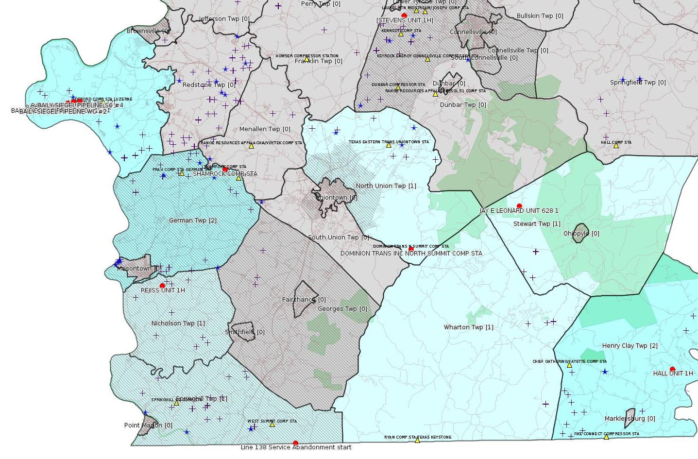
Click the map to enlarge
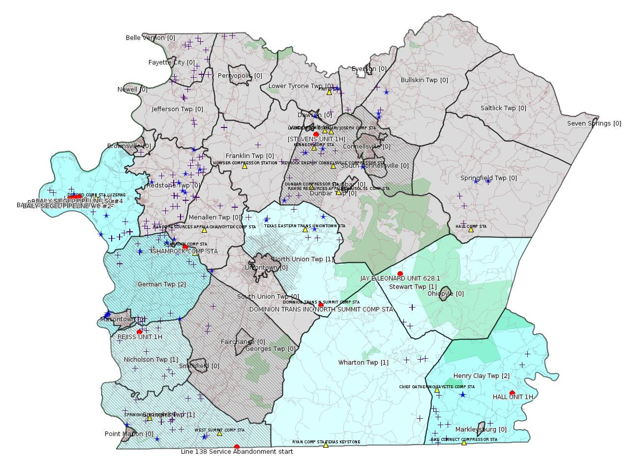
Map
Key
Red dots: items in this permit list with an exact location.
Blue stars: Marcellus Gas Well Water Sources.
Municipality shading: number of "facilities", with each well counting separately
(includes the red dots):
Red dots: items in this permit list with an exact location.
Blue stars: Marcellus Gas Well Water Sources.
Municipality shading: number of "facilities", with each well counting separately
(includes the red dots):
gray: 0
pale turquoise: 1
turquoise: 2
pale blue: 3
middle blue: 4
dark blue: 6
dark purple: 11
purple: 19
(Color coding may differ from one issue to the next.)
(Note if a project spans multiple municipalities -- e.g. a pipeline -- it will show in the count for each municipality.)
The number of facilities also follows the municipality name in brackets.
Municipality counts are based on the way the permit is listed by DEP; DEP has been known to get a municipality wrong.
Locations in brackets identify a precise location used to locate a surrogate for the actual site being permitted (e.g. locating a well pad or pipeline by the known location of a well.) Locations labeled beginning with "~" and ending in "[?]" are approximate and speculative based on inferences using on-line property and lease records. These are marked in the text as "[Approximate, Speculative]
Cross-hatching: Environmental Justice Areas
Yellow triangles: Compressor Stations
Crosses: Unconventional well permits (may not have been drilled)
Green: "Natural areas", e.g. state game lands, state forests
Yellow triangles: Compressor Stations
Crosses: Unconventional well permits (may not have been drilled)
Green: "Natural areas", e.g. state game lands, state forests
More Maps
 |
 |
Source: Pennsylvania Bulletin
Approval Order
Public Meeting Held
March 10, 2016
Commissioners Voting: John F. Mizner, Esq., Chairperson; George D. Bedwick, Vice Chairperson; W. Russell Faber; Murray Ufberg, Esq.; Dennis A. Watson, Esq.
Environmental Quality Board—
Additional RACT Requirements for Major
Sources of NOx and VOCs
Regulation No. 7-485 (#3052)
On April 7, 2014, the Independent Regulatory Review Commission (Commission) received this proposed regulation from the Environmental Quality Board (EQB). This rulemaking amends 25 Pa. Code Chapters 121 and 129. The proposed regulation was published in the April 19, 2014 Pennsylvania Bulletin with a 72-day public comment period. The final-form regulation was submitted to the Commission on January 14, 2016.
This regulation adds additional Reasonably Available Control Technology requirements and emission limitations for major stationary emission sources.
We have determined this regulation is consistent with the statutory authority of the EQB (35 P.S. § 4005(a)(l)) and the intention of the General Assembly. Having considered all of the other criteria of the Regulatory Review Act, we find promulgation of this regulation is in the public interest.
By Order of the Commission:
This regulation is approved.
<http://www.pabulletin.com/secure/data/vol46/46-13/533.html>
---
Proposed State Water Quality Certification
Required by Section 401 of the Clean Water Act for the Line 138 Service Abandonment and
Lateral Construction Project
Southwest Region: Waterways & Wetlands Program, 400 Waterfront Drive, Pittsburgh, PA 15222, Rita A. Coleman, 412-442-4000
WQ05-011, Columbia Gas Transmission, LLC (Applicant), 1700 MacCorkle Avenue, S.E. Charleston, WV 25314. Line 138 Service Abandonment and Lateral Construction Project (Project), in Springhill, Henry Clay and Wharton Townships, Fayette County and Addison and Elk Lick Townships, Somerset County, ACOE Pittsburgh District. The proposed project starts approximately 2.25 miles southeast of the intersection of State Route 857 and Gans Road in Springhill Township, Fayette County (Lake Lynn, PA, WV Quadrangle N: 39°, 43`, 16"; W: -79°, 45`, 49") and ends approximately 0.7 mile southwest of the intersection of State Route 669 and Ash Hill Road in Elk Lick Township, Somerset County (Grantsville, MD, PA Quadrangle N: 39°, 43`, 22"; W: -79°, 10`, 18")
On May 20, 2015, Applicant filed an application with the Federal Energy Regulatory Commission (FERC) under Section 7 of the Natural Gas Act (15 U.S.C. § 717f) seeking a certificate of public convenience and necessity to construct and operate its Project (FERC Docket No. CP15-495-000). The FERC Environmental Assessment for the Project, which was issued on 9/17/15, may be viewed on FERC's website at www.ferc.gov (search eLibrary; Docket Search; CP15-495-000).
On August 14, 2015, Applicant requested a state water quality certification from the Pennsylvania Department of Environmental Protection (PADEP), as required by Section 401 of the Clean Water Act (33 U.S.C. § 1341), to ensure that the construction, operation and maintenance of the Project will protect water quality in Pennsylvania through compliance with State water quality standards and associated State law requirements, which are consistent with the requirements of the Clean Water Act.
The Project, as proposed would operate and maintain some segments of the existing, approximately 33-mile, Line 138 natural gas pipeline, consisting of 4-inch, 6-inch, 8-inch and 16-inch pipeline, within an existing 50-foot right-of-way, where service is being abandoned. Columbia proposes to remove approximately 0.18 mile of exposed pipeline, two (2) residential tap consumers, two (2 ) meter stations, one (1) odorizer, one (1) siphon, five (5) ground valves and eight (8) mainline valves. Columbia plans to grout 28 road crossings to abandon in place.
Columbia also proposes to construct an approximate 0.65-mile, 2-inch lateral extension within the existing 50-foot wide Line 138 right-of-way (ROW) in order to maintain service to the Firm Transportation customer and their operations. The Firm Transportation customer is served from Line 138 through which service will be abandoned, Columbia proposes to maintain gas service to this customer by installing a lateral extension within the Line 138 ROW to connect with Lines 1804 and 10240. The lateral extension project will involve construction activities within the existing 50-foot wide ROW, acquisition of 50 feet of new ROW to connect the lateral to the Line 1804 and 10240 ROW, two (2) new isolation valves on Lines 1804 and 10240, and a contractor/staging yard all located in Somerset County Pennsylvania. The proposed lateral extension activities are herein referred to as the ''Lateral Construction Project''.
In Pennsylvania, the Project, as proposed, will require impacts to 0.3416 acre of Laurel Run (HQ-CWF), Reason Run (WWF), Collier Run (WWF) and Zehner Run (HQ-CWF), and unnamed tributaries of Patterson Run (HQ-CWF), Big Sandy Creek (HQ-CWF), Youghiogheny River (WWF), Chub Run (WWF), Mill Run (WWF), Zehner Run (HQ-CWF), Big Shade Run (CWF), 5.05 acres of floodway, 0.8664 acre of temporary PEM wetland impacts, and 0.0292 acre of PEM and PSS permanent impacts.
PADEP anticipates issuing a state water quality certification to Applicant for the Project that will require compliance with the following State water quality permitting programs, criteria and conditions established pursuant to State law to ensure the Project does not violate applicable State water quality standards set forth in 25 Pa. Code Chapter 93:
1. Discharge Permit—Applicant shall obtain and comply with a PADEP National Pollutant Discharge Elimination System (NPDES) permit for the discharge of water from the hydrostatic testing of the pipeline pursuant to Pennsylvania's Clean Streams Law (35 P.S. §§ 691.1—691.1001), and all applicable implementing regulations (25 Pa. Code Chapter 92a).
2. Erosion and Sediment Control Permit—Applicant shall obtain and comply with PADEP's Chapter 102 Erosion and Sediment Control General Permit for Earth Disturbance Associated with Oil and Gas Exploration, Production, Processing or Treatment issued pursuant to Pennsylvania's Clean Streams Law and Storm Water Management Act (32 P.S. §§ 680.1—680.17), and all applicable implementing regulations (25 Pa. Code Chapter 102).
3. Water Obstruction and Encroachment Permits—Applicant shall obtain and comply with a PADEP Chapter 105 Water Obstruction and Encroachment Permits for the construction, operation and maintenance of all water obstructions and encroachments associated with the project pursuant to Pennsylvania's Clean Streams Law, Dam Safety and Encroachments Act (32 P.S. §§ 673.1—693.27), and Flood Plain Management Act (32 P.S. §§ 679.101—679.601.), and all applicable implementing regulations (25 Pa. Code Chapter 105).
4. Water Quality Monitoring—PADEP retains the right to specify additional studies or monitoring to ensure that the receiving water quality is not adversely impacted by any operational and construction process that may be employed by Applicant.
5. Operation—Applicant shall at all times properly operate and maintain all Project facilities and systems of treatment and control (and related appurtenances) which are installed to achieve compliance with the terms and conditions of this State Water Quality Certification and all required permits, authorizations and approvals. Proper operation and maintenance includes adequate laboratory controls, appropriate quality assurance procedures, and the operation of backup or auxiliary facilities or similar systems installed by Applicant.
6. Inspection—The Project, including all relevant records, are subject to inspection at reasonable hours and intervals by an authorized representative of PADEP to determine compliance with this State Water Quality Certification, including all required State water quality permits and State water quality standards. A copy of this certification shall be available for inspection by the PADEP during such inspections of the Project.
7. Transfer of Projects—If Applicant intends to transfer any legal or equitable interest in the Project which is affected by this State Water Quality Certification, Applicant shall serve a copy of this certification upon the prospective transferee of the legal and equitable interest at least thirty (30) days prior to the contemplated transfer and shall simultaneously inform the PADEP Regional Office of such intent. Notice to PADEP shall include a transfer agreement signed by the existing and new owner containing a specific date for transfer of certification responsibility, coverage, and liability between them.
8. Correspondence—All correspondence with and submittals to PADEP concerning this State Water Quality Certification shall be addressed to the Department of Environmental Protection, Southwest Regional Office, Rita A. Coleman, Program Manager, Waterways and Wetlands Program, 400 Waterfront Drive, Pittsburgh, PA 15222.
9. Reservation of Rights—PADEP may suspend or revoke this State Water Quality Certification if it determines that Applicant has not complied with the terms and conditions of this certification. PADEP may require additional measures to achieve compliance with applicable law, subject to Applicant's applicable procedural and substantive rights.
10. Other Laws—Nothing in this State Water Quality Certification shall be construed to preclude the institution of any legal action or relieve Applicant from any responsibilities, liabilities, or penalties established pursuant to any applicable Federal or State law or regulation.
11. Severability—The provisions of this State Water Quality Certification are severable and should any provision of this certification be declared invalid or unenforceable, the remainder of the certification shall not be affected thereby.
Prior to issuance of the final state water quality certification, PADEP will consider all relevant and timely comments, suggestions or objections submitted to PADEP within 30 days of this notice. Comments should be directed to Rita Coleman, Waterways and Wetlands Program Manager at the above address or through the Pennsylvania AT&T Relay Service at (800) 654-5984 (TDD). Comments must be submitted in writing and contain the name, address and telephone number of the person commenting and a concise statement of comments, objections or suggestions on this proposal. No comments submitted by facsimile will be accepted.
<http://www.pabulletin.com/secure/data/vol46/46-14/561c.html>
Location (start): 39.721111,79.7625 (extending eastward along the PA southern borderline into Somerset County)
-------------------------
Source: eNOTICE (+ PA Oil and Gas Mapping) Please see the Disclaimer below regarding Parcel Id data.
Authorization ID: 1104422
Permit number: 051-20051
Site: JAY E LEONARD UNIT 1 OG WELL
Client: XTO ENERGY INC
Authorization type: Well Plugging Notice Intent to Plug Single Well
Application type: New
Authorization is for: FACILITY
Date received: 01/11/2016
Status: Pending
Sub-Facility ID Sub-Facility Name Description
56258 JAY E LEONARD UNIT 628 1 Well
<http://www.ahs.dep.pa.gov/eFACTSWeb/searchResults_singleAuth.aspx?AuthID=1104422>
Location: 39.889047,-79.551017 <http://osm.org/go/ZWpt7Qzi--?m=>
Municipalities: Stewart Twp
Presumed Parcel ID: 37060019
Authorization ID: 1103641
Permit number: GP05260715-007
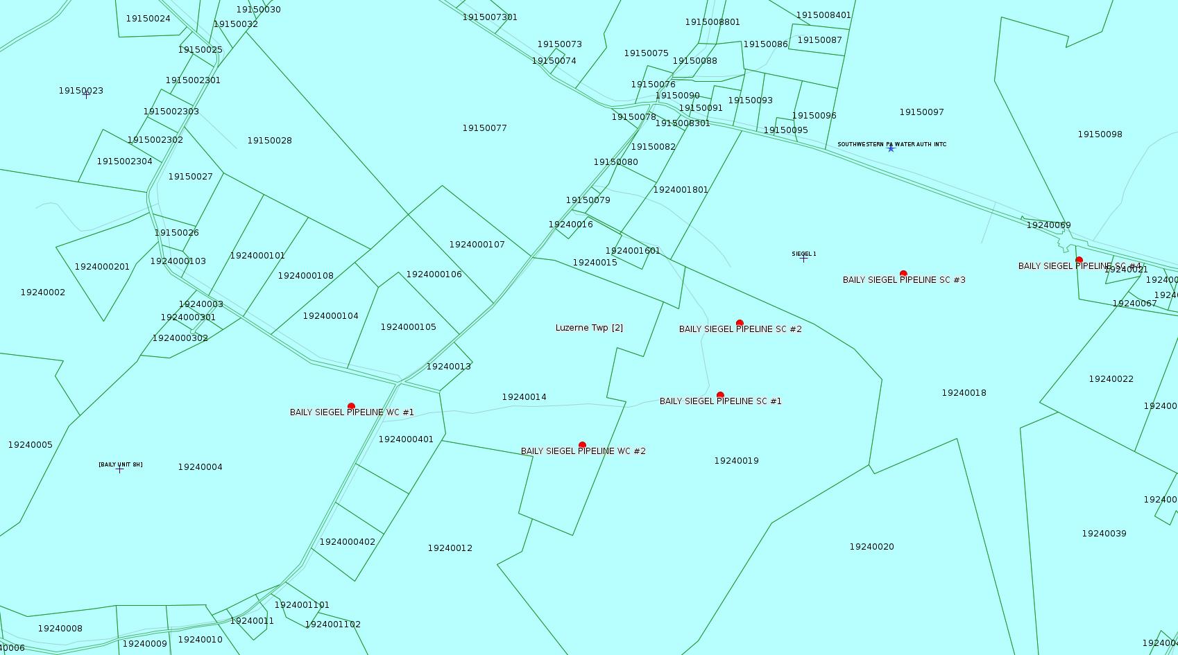
Site: BAILY SIEGEL PIPELINE
Client: LAUREL MTN MIDSTREAM OPR LLC
Authorization type: GP-05 Utility Line Stream Crossings
Application type: New
Authorization is for: FACILITY
Date received: 12/17/2015
Status: Issued on 3/24/2016
Sub-Facility ID Sub-Facility Name Description
1208625 SC #1 HEREFORD HOLLOW Pipeline or Conduit
1208628 SC #2 UNT 1 TO HEREFORD HOLLOW Pipeline or Conduit
1208629 SC #3 TRIB 41001 TO HEREFORD HOLLOW Pipeline or Conduit
1208633 SC #4 UNT 1 TO KELLEY RUN Pipeline or Conduit
1203656 WC #1 1005151134 PFO Pipeline or Conduit
1208624 WC #2 1026151014 PSS/PFO Pipeline or Conduit
<http://www.ahs.dep.pa.gov/eFACTSWeb/searchResults_singleAuth.aspx?AuthID=1103641>
Locations:
SC1: 39.965520,-79.971594 <http://osm.org/go/ZWpZF4Ki--?m=>
SC2: 39.967335,-79.970931
SC3: 39.968542,-79.965531
SC4: 39.968830,-79.959744
WC1: 39.965336,-79.983714
WC2: 39.964291,-79.976136 <http://osm.org/go/ZWpZFODT--?m=>
Municipalities: Luzerne Twp
Presumed Parcel IDs Include [See Notes]: 19240004, 1924000401, 19240014, 19240019, 19240018, 1924006701 [??]
Authorization ID: 1103642
Permit number: GP08620715006
Site: BAILY SIEGEL PIPELINE
Client: LAUREL MTN MIDSTREAM OPR LLC
Authorization type: GP-08 Temporary Road Crossings
Application type: New
Authorization is for: FACILITY
Date received: 12/17/2015
Status: Issued on 3/24/2016
Sub-Facility ID Sub-Facility Name Description
1203657 BAILY SIEGEL PIPELINE GP08260715-006 Culvert
1208631 FC #1 UNT 2 TO TRIB 41001 HEREFORD HOLLOW Bridge
1208626 SC #1 HEREFORD HOLLOW Bridge
1208627 SC #2 UNT 1 TO HEREFORD HOLLOW Bridge
1208630 SC #3 TRIB 41001 TO HEREFORD HOLLOW Bridge
1208632 SC #4 UNT 1 TO KELLEY RUN Bridge
1208620 WC #1 1005151134 PFO Bridge
1208621 WC #1 1005151134 PFO Temporary Wetland Impact
1208622 WC #2 1026151014 PSS/PFO Temporary Wetland Impact
1208623 WC #2 1026151014 PSS/PFO Bridge
<http://www.ahs.dep.pa.gov/eFACTSWeb/searchResults_singleAuth.aspx?AuthID=1103642>
Authorization ID: 1130367
Permit number: ESX16-051-0001
Site: STEVENS UNIT 1H 2H ESCGP-2 EXPEDITED
Client: XTO ENERGY INC
Authorization type: Expedited E&S Stormwater General Permit 1
Application type: New
Authorization is for: SITE
Date received: 03/23/2016
Status: Pending
<http://www.ahs.dep.pa.gov/eFACTSWeb/searchResults_singleAuth.aspx?AuthID=1130367>
Location [of STEVENS UNIT 1H]: 40.027158,-79.655672 <http://osm.org/go/ZWp22x0B--?m=>
Municipalities: Dunbar Twp
Presumed Parcel ID: 09050277
[See Notes.]
Authorization ID: 611359
Permit number: 26-00405
Site: DOMINION TRANS INC NORTH SUMMIT COMP STA
Client: DOMINION TRANS INC
Authorization type: Major Facility Operating Permit
Application type: Modification
Authorization is for: FACILITY
Date received: 11/01/2005 [!!]
Status: Pending
Sub-Facility ID Sub-Facility Name Description
234591 TULPRO HEATER 1 (25 MMBTU/HR) Combustion Unit
<http://www.ahs.dep.pa.gov/eFACTSWeb/searchResults_singleAuth.aspx?AuthID=611359>
Location: 39.859276,-79.6526 <http://osm.org/go/ZWpnipjq--?m=> [See Notes.]
Municipalities: North Union Twp
Parcel ID: 25550029U00
Authorization ID: 1037865
Permit number: 26-00405
Site: DOMINION TRANS INC NORTH SUMMIT COMP STA
Client: DOMINION TRANS INC
Authorization type: Major Facility Operating Permit
Application type: Renewal
Authorization is for: FACILITY
Date received: 08/12/2014
Status: Pending
Sub-Facility ID Sub-Facility Name Description
234592 ENGINE 1 COOPER 3200 HP Process
234593 ENGINE 2 COOPER 3200 HP Process
490401 NATCO DEHY HEATER 3 (TWO 5.25 MMBTU/HR BURNERS) Combustion Unit
490402 PEERLESS BOILER (3.57 MMBTU/HR) Combustion Unit
889649 STORAGE TANKS SUBJECT TO 129.57 Process
234591 TULPRO HEATER 1 (25 MMBTU/HR) Combustion Unit
490400 TULPRO HEATER 2 (25 MMBTU/HR) Combustion Unit
490403 WAUKESHA 668 BHP AUXILIARY GENERATOR Process
<http://www.ahs.dep.pa.gov/eFACTSWeb/searchResults_singleAuth.aspx?AuthID=1037865>
[Location above.]
Authorization ID: 1037455
Permit number: 051-24441
Site: HALL UNIT 1H OG WELL
Client: CHEVRON APPALACHIA LLC
Authorization type: Drill & Operate Well Permit Inactive Status
Application type: New
Authorization is for: FACILITY
Date received: 08/07/2014
Status: Pending
Sub-Facility ID Sub-Facility Name Description
1023640 HALL UNIT 1H Well
<http://www.ahs.dep.pa.gov/eFACTSWeb/searchResults_singleAuth.aspx?AuthID=1037455>
Location: 39.769931,-79.410864 <http://osm.org/go/ZWrAf9i~--?m=>
Municipalities, Henry Clay Twp
Presumed Parcel ID: 16130134
Authorization ID: 1131286
Permit number: 26-00588
Site: SHAMROCK COMP STA
Client: LAUREL MTN MIDSTREAM OPR LLC
Authorization type: Minor Facility Plan Approval New Source Performance Std
Application type: Extension
Authorization is for: FACILITY
Date received: 03/30/2016
Status: Pending
<http://www.ahs.dep.pa.gov/eFACTSWeb/searchResults_singleAuth.aspx?AuthID=1131286>
Location: 39.918333,-79.825 <http://osm.org/go/ZWpasXGm--?m=>
Municipalities: German Twp [an Environmental Justice Area]
Parcel ID: 15140026
[See Notes.]
Authorization ID: 1131297
Permit number: 26-00588A
Site: SHAMROCK COMP STA
Client: LAUREL MTN MIDSTREAM OPR LLC
Authorization type: Major Facility Plan Approval New Facility Review Prevention of Significant Deterioration
Application type: Extension
Authorization is for: FACILITY
Date received: 03/30/2016
Status: Pending
<http://www.ahs.dep.pa.gov/eFACTSWeb/searchResults_singleAuth.aspx?AuthID=1131297>
-------------------------
Source: DEP Oil and Gas Compliance Report
OPERATOR: CHEVRON APPALACHIA LLC
INSPECTION_ID: 2467634
INSPECTION_DATE: 03/16/2016
INSPECTION_TYPE: Complaint Inspection
API_PERMIT: 051-24515
FARM_NAME: REJISS UNIT 1H
UNCONVENTIONAL: Y
SITE_ID: 763903
SITE_NAME: REJISS UNIT 1H OG WELL
FACILITY_TYPE: Oil & Gas Location
INSPECTION_CATEGORY: Primary Facility
REGION: EP DOGO SWDO Dstr Off
COUNTY: Fayette
MUNICIPALITY: Nicholson Twp
INSPECTOR: NAJEWICZ, JUSTIN
INSPECTION_RESULT_DESCRIPTION: Violation(s) Noted
INSPECTION_COMMENT: "On 03/16/16 at approximately 0930 hours I conducted a complaint inspection of the Rejiss well site. The Act 9 sign was in place and all required documents were present at the site.
The site overall was well vegetated and there were no signs of erosion & sedimentation at the site. A significant amount of stone was also present on the slope of the topsoil stock pile at the southern corner of the well site. It is recommended that this be removed.
The complaint against the site alleged that it was not built to the specifications of the approved E&S plans and that the stockpiles were causing environmental concerns. No environmental harm was observed due to the stock piles. The site appears to have been built to plan with the exception of two locations of gravel that appear to be gravel pull offs. One is located near the main site entrance on the northeast side of the access road and the second is near the debris pile on the southwestern access road. This is a violation of 102.5(m)(4).
"
VIOLATION_ID: 755143
VIOLATION_DATE: 03/16/2016
VIOLATION_CODE: 102.5(m)4 - PERMIT REQUIREMENTS – GENERAL PERMITS – Person failed to comply with the terms and conditions of the E & S Control General Permit.
VIOLATION_TYPE: Environmental Health & Safety
VIOLATION_COMMENT:
RESOLVED_DATE:
RESOLUTION_REASON_CODE_DESCRIPTION:
ENFORCEMENT_ID: 341063
ENFORCEMENT_CODE_DESCRIPTION: NOV - Notice of Violation
DATE_EXECUTED: 03/25/2016
ENFORCEMENT_FINAL_DATE:
ENFORCEMENT_FINAL_STATUS:
PENALTY_FINAL_DATE:
PENALTY_FINAL_STATUS_CODE_DESCRIPTION:
PENALTY_AMOUNT:
TOTAL_AMOUNT_COLLECTED:
Location: 39.835447,-79.884836 <http://osm.org/go/ZWpOF2yQ--?m=>
Presumed Parcel ID: 24040032
There is a similar notice for REJISS UNIT 2H and REJISS UNIT 3H.
-------------------------
Source: Reuters Commodities: Energy
Natural Gas
| Commodity | Exchange | Currency | Expire | Last Trade | Trade Time | Change | Open | Day's High | Day's Low |
|---|---|---|---|---|---|---|---|---|---|
| NATURAL
GAS CON1 Apr16 |
NYM | USD | 04/27 | 2.01 | 04/04 14:07 | +0.05 | 1.99 | 2.07 | 1.98 |
-------------------------
Notes:
For a pipeline permit, the list labeled "Presumed Parcel IDs Include" is derived from those locations where DEP has listed a latitude and longitude (e.g. stream crossings) together with some parcels whose ID may be able to be inferred by interpolation. Such a list may be incomplete.
---
The Facility Record for STEVENS UNIT 1H,
<http://www.ahs.dep.pa.gov/eFACTSWeb/searchResults_singleFacility.aspx?FacilityID=735807>, shows:
Corrective Action/Tank Closure requirements remain outstanding for incidents in Inactive status.
(It actually shows in red on the eFACTS web page.) It's possible this "corrective action" is what the permit above is for, rather than new wells at this site.
---
The location published by DEP in its "eMapPa" link for authorization 611359 for the Dominion Transmission North Summit Compressor Station, is almost certainly wrong. The latitude and longitude shown above were determined by correlating a geolocated address in the Site Record for this facility and adjusting to match satellite photographs. The parcel id was determined based on the Marcellus Shale Task Force list of compressor stations (which has always been seriously incomplete). It is unfortunate, but locating compressor stations is a hit and miss business; there are many errors in DEP records, and some of the frequently used mapping locations have data that is a complete mess. I am unable at this time to present a link to a complete and correct list of the locations of all compressor stations in Fayette County. In general, the best way to locate a compressor station is to extract latitude and longitude from an eMapPa link shown in the Facility Search record. But such locations have to be verified, because there are many errors in these links. Such errors also infect the "official" PASDA geolocations for "Air Emission Plants". (For the current version of this data see
<ftp://www.pasda.psu.edu/pub/pasda/dep/AirEmissionPlants2016_01.zip>.)
The Dominion Transmission North Summit Compressor Station is associated with Fayette County's one existing "jurisdictional" (FERC) Natural Gas Storage Field. Wells associated with that storage field were recently inspected by DEP, and several wells were found to have leaking valves. See the Oil and Gas Compliance Report section of the 12/13/15 issue of this bulletin:
<http://www.faymarwatch.org/happening/permits/121315.shtml>
---
The permit situation for Shamrock Compressor Station is very confusing. Laurel Mountain Midstream keeps extending both "old" permits for this facility and newer permits, apparently due to delays installing equipment covered under the newer permits.
Although it is not consistently used, Fayette County actually has a land use code, I-95, for compressor stations: "COMPRESSOR STATION FOR GAS LINE TRANS". The parcel shown above for Shamrock actually does have this code.
------------------------
DEP defines an environmental justice area as "any census tract where 20 percent or more individuals live in poverty, and/or 30 percent or more of the population is minority". (See:
<http://www.portal.state.pa.us/portal/server.pt/community/pa_environmental_justice_areas/20991>
<http://www.portal.state.pa.us/portal/server.pt/community/dep_enhanced_public_participation_policy/20988>
). There are supposed to be enhanced public participation requirements for permits in environmental justice areas, but news of this actually ever happening is scarce. In Fayette County, the entirety of Springhill, Nicholson, German, and Georges Townships are environmental justice areas, as well as a large part of Dunbar Township. DEP's policy document on public participation guidelines for environmental justice areas is located here:
<http://www.elibrary.dep.state.pa.us/dsweb/Get/Version-48671/012-0501-002.pdf>
eNOTICE records are likely to list the same permit multiple times, as that permit moves through the DEP process.
Oil & Gas Wells designated with a site a number and the letter H typically designate horizontal wells.
-------------------------
Resources:
Pennsylvania Bulletin: <http://www.pabulletin.com/>
eNOTICE: <http://www.ahs2.dep.state.pa.
DEP Well Details Report: <https://www.paoilandgasreport
Well Details may not show any
information for new permits and will not show permits which have
not yet been issued. Lookup for Well Details is by permit number.
DEP Permits Issued Detail Report:
<http://www.depreportingservic
DEP SPUD (drilling started) Report:
<http://www.depreportingservices.state.pa.us/ReportServer/Pages/ReportViewer.aspx?/Oil_Gas/Spud_External_Data>
DEP Oil and Gas Compliance Report:
<http://www.depreportingservices.state.pa.us/ReportServer/Pages/ReportViewer.aspx?/Oil_Gas/OG_Compliance>
DEP PA Oil & Gas Mapping:
<http://www.depgis.state.pa.us/PaOilAndGasMapping>
Fayette County Assessment Office Search For Tax Records:
<http://property.co.fayette.pa.us/search.aspx>
Pennsylvania Spatial Data Access:
<http://www.pasda.psu.edu/default.asp>
DEP Spatial Data Repository:
<ftp://www.pasda.psu.edu/pub/pasda/dep/>
National Response Center:
<http://www.nrc.uscg.mil/>
EPA-Echo: <http://www.epa-echo.gov/echo/
FERC citizen involvement: <http://www.ferc.gov/for-citiz
To receive E-mail notification of
all documents filed in a FERC docket, see:
<http://www.ferc.gov/docs-filing/esubscription.asp >
<http://www.ferc.gov/docs-fili
Follow the directions and enter the docket number to subscribe to.
Township Supervisors receive information regarding Erosion & Sedimentation permits, and these records may be reviewable at township municipal offices.
DEP permits are reviewable through the File Review process, for application to do file review see: <http://www.portal.state.pa.us/portal/server.pt/community/southwest_regional_office/13775/file_review/593164>
Environmental Hearing Board: <http://ehb.courtapps.com/publ
PA DEP Environmental Policy Comment System:
<http://www.ahs.dep.pa.gov/eComment/>
Federal Register Environment: <https://www.federalregister.g
Browsing of recent comment
opportunities for federal agencies, e.g. EPA. Click "sign up" to
subscribe to daily E-mails of new document listings.
SkyTruth Fayette County Drilling Alerts: <http://frack.skytruth.org/pen
EPA Pennsylvania Public Notices: <http://www2.epa.gov/aboutepa/epa-pennsylvania#notice>
Marcellus Shale waste disposal
injection wells in Pennsylvania are regulated directly by EPA, not
DEP. Notice of any new permit applications will appear at the
above web address. I'm not aware of any subscription service
to be notified of such applications. I'm not aware of any
Marcellus Shale waste disposal injection wells in Fayette County
(yet ...) but we need to monitor this page for future
applications.
Energy Assurance Daily: <http://www.oe.netl.doe.gov/ead.aspx>
Daily newsletter from the US
Department of Energy about events relating to energy. The Natural
Gas section has information about pipelines.
-------------------------
Disclaimers:
This compilation from the above sources was done by hand using copy and paste and may omit relevant permits.
Parcel data is provided via the tax records search web page offered by the Fayette County Assessment Office (http://property.co.fayette.pa.us/). Presumed Parcel Id links are subject to availability provided by that agency and associated web sites. Presumed Parcel Ids are determined as the mapped parcel containing a given latitude and longitude, are a best effort determination which is subject to error, and are not official. In cases where a facility is leased and there is a separate parcel id for the lease, if this parcel id is not separately mapped, the parcel id shown will be the id for the enclosing parcel. Parcel owners may be surface owners only and may or may not have any relationship to oil & gas facilities.
Does not currently include water supply permits. Does not include landfill permits even though many such are for Marcellus Shale waste. (It is not possible at this time to distinguish which landfill permits are for Marcellus Shale waste and which are not without doing File Review for each permit.)
Erosion & Sedimentation permit records do not currently include latitude and longitude. Where I am publishing latitude and longitude with E&S permits it is by inferring an associated well permit and using published latitude and longitude for the well. It is possible I may be inferring the wrong well site.
Municipalities are shown from eFACTS records on the DEP web site. The DEP has been known to list a municipality incorrectly.